This Location At A Glance
This junction is located in . NOTE: Denoted by four flags at bridge zenith over the Detroit River.
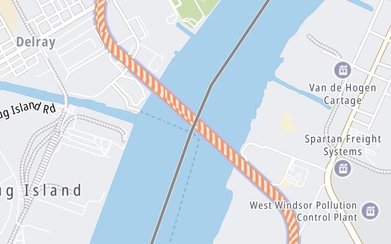
This location's approximate GPS Coordinates are 42.28770 x -83.09791.
Which directions can I travel from here?
From this junction, traffic can enter traveling both westbound and eastbound. Traffic can also exit traveling both westbound and eastbound.
On to Canada Customs (CBSA) commercial lanes, about 0.9 miles away ►
◄ Back to US Customs (CBP) commercial lanes, about 1.1 miles away.
Nearby gas and food are shown on the interactive map below.
Weather & Visibility

Cloudy
53°F / 11.5°C
Feels Like
52°F / 10.9°C

Visibility
10 Mi / 16.1 Km
3 Hr Precip
0 In / 0.0 Cm

-
WNW Wind
6.6 Mi / 10.7 Km
Gusts
10.6 Mi / 17.1 Km
Conditions and forecasts provided in partnership with AccuWeather.

Weather provided in partnership with AccuWeather.
Available Cameras

1.57 Mi
1.62 Mi
2.37 Mi
2.38 Mi
2.57 Mi


 Peace Bridge ▹
 Rainbow Bridge ▹
 Mackinac Bridge ▹
 Ambassador Bridge ▹
 Detroit Windsor Tunnel ▹
 New York State Thruway ▹
 Niagara Thruway ▹


 Liberty Bridge ▹
 Independence Bridge ▹