This Location At A Glance
This junction is located in Fair Oaks. Tulsa is nearby.
This location is in the Tulsa area.
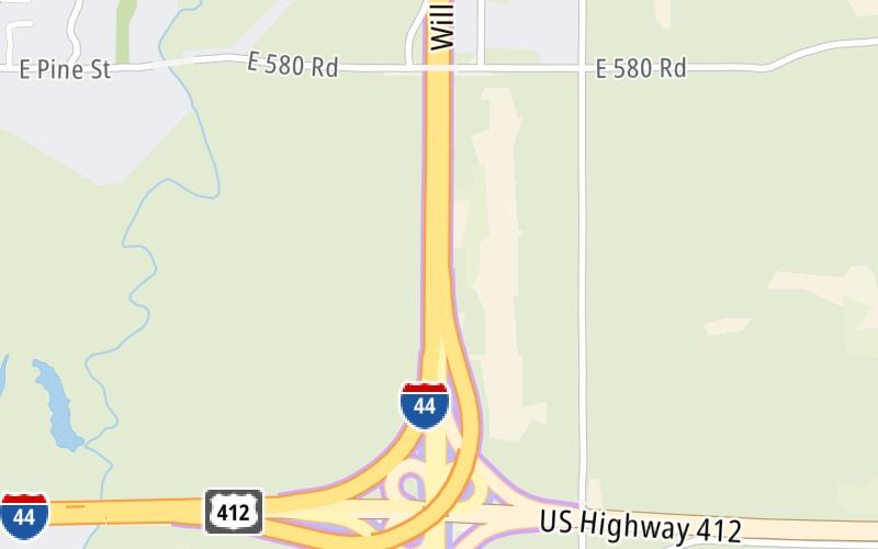
This location's approximate GPS Coordinates are 36.17042 x -95.73200.
Which directions can I travel from here?
From this junction, traffic can only enter going westbound. Traffic can only exit going eastbound.
◄ Back to US 412 West/I-44 West, about 0.2 miles away.
▹ The Creek Turnpike and the Will Rogers Turnpike connect here.
Nearby gas and food are shown on the interactive map below.
Weather & Visibility

Clear
54°F / 12.4°C
Feels Like
54°F / 12.4°C

Visibility
11 Mi / 17.7 Km
3 Hr Precip
0 In / 0.0 Cm

-
NNE Wind
4 Mi / 6.4 Km
Gusts
7.6 Mi / 12.2 Km
See the full forecast for This Location or the Tulsa area
Conditions and forecasts provided in partnership with AccuWeather.

Weather provided in partnership with AccuWeather.
Available Cameras
No camera feed …
There is no currently-available traffic camera feed for this location.


 Cherokee Turnpike ▹
 Creek Turnpike ▹
 Muskogee Turnpike ▹
 Turner Turnpike ▹
 Will Rogers Turnpike ▹
 Gilcrease Expressway West ▹

 H E Bailey Turnpike ▹
 Indian Nation Turnpike ▹
 John Kilpatrick Turnpike ▹
 Kickapoo Turnpike ▹
 Chickasaw Turnpike ▹

 Addison Airport Toll Tunnel ▹
 Chisholm Trail Parkway ▹
 Dallas North Tollway ▹
 Lewisville Lake Toll Bridge ▹
 Mountain Creek Lake Toll Bridge ▹
 President George Bush Turnpike ▹
 Sam Rayburn Tollway ▹
 360 Tollway ▹
 Kansas Turnpike ▹


