Interactive map shows available cameras, plus nearby fuel, food and lodging
See below for more about this area
This is Exit 41 of the Massachusetts Turnpike.
This junction is located in Westfield. Northampton is nearby. NOTE: (Old Exit 3) Westfield.
This location is in the Springfield - Westfield area.
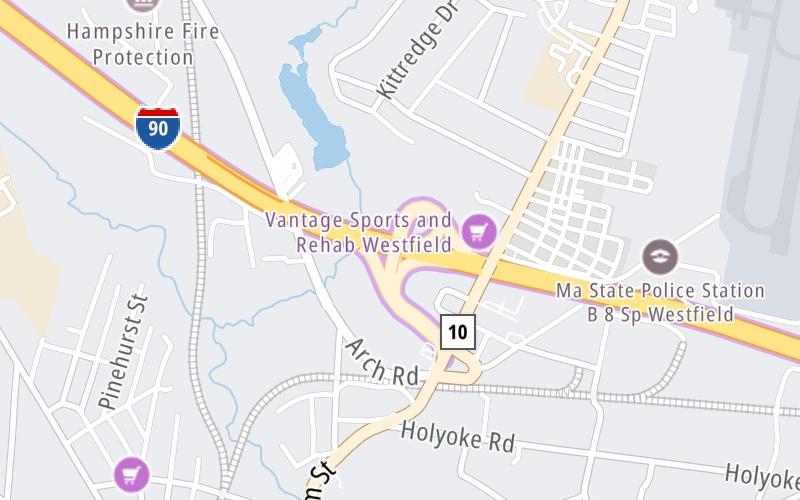
This location's approximate GPS Coordinates are 42.14488 x -72.73520.
Which directions can I travel from here?
From this junction, traffic can enter traveling both westbound and eastbound. Traffic can also exit traveling both westbound and eastbound.
On to I-91 / US 5, about 4.6 miles away ►
◄ Back to Blandford Service Plaza Eastbound, about 11.6 miles away.
This location also connects with Connecticut.
Which direction are tolls charged here?
The interactive map and lists on this page include key traveler services within two miles of this destination point.
You will find common services, including gas stations, truck stops, EV charging facilities, fast-food or family restaurants, and hotels. These are displayed on the interactive map as markers, which you can select for more information.
Current driving conditions and weather, along with a more complete list of key services, may be found below the map.
Static map. Interactive map is above.Mostly Cloudy
79°F / 26°C
Feels Like:
81°F / 27.3°C
Visibility
12 Mi / 19.3 Km
3-Hour Precip:
0.01 In / 0.0 Cm
North Northwest
Winds (NNW)
1.7 MPH / 2.7 KPH
Gusts:
5 MPH / 8.1 KPH
▸ Get the full forecast for This Location | The Springfield - Westfield area
The map above shows all services within about a two (2) mile radius.
Destination Travel
Closest Gas Stations
SHELL
259 North Elm Street • 0.65 miles
Store/Fuel Brand: Shell
MOBIL
162 Southampton Road • 1,293 feet
Store/Fuel Brand: Mobil
CITGO
439 North Elm Street • 1,751 feet
Store/Fuel Brand: Citgo
GULF
278 Elm Street • 1.42 miles
Store/Fuel Brand: Gulf
Closest EV Chargers
Closest Fast Food
Fast food refers ONLY to quick-service and take-out diners. All restaurant types are shown on the map above.
ALESSIO'S PIZZA
280 Southampton Road • 0.38 miles
DUNKIN'
127 North Elm Street • 0.73 miles
MCDONALD'S
182 North Elm Street • 0.81 miles
WENDY'S
2 Southampton Road • 1,254 feet
DUNKIN'
439 North Elm Street • 1,766 feet
DUNKIN'
212 Southampton Road • 1,784 feet
MI RANCHITO TEX MEX
69 Franklin Street • 1.60 miles
Journey to key destinations around and adjacent to Massachusetts!
Communities in this metro area include Boston, Cambridge, Chelsea, Allston, Framingham, Westborough, and Worcester.
Individual toll maps for this region are listed below.
Communities in this metro area include Springfield, West Springfield, Chicopee, Westfield, and Hartford, Connecticut.
Individual toll maps for this region are listed below.
Communities in this metro area include Hooksett, Concord, Manchester, and West Concord.
Individual toll maps for this region are listed below.
Communities in this metro area include Albany, Schenectady, Rotterdam, Amsterdam, and West Stockbridge, Massachusetts.
Individual toll maps for this region are listed below.