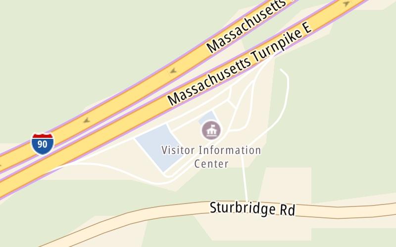
This travel plaza is located in Charlton. Sturbridge is nearby.
This location is in the Boston area; it also overlaps with the Springfield - Westfield area.
This location's approximate GPS Coordinates are 42.14000 x -72.02488.
On to Charlton Service Plaza Westbound, about 4.6 miles away ►
◄ Back to I–84, about 1.9 miles away.
Above: Map image © TomTom Intl BVThe interactive map and lists on this page include key traveler services within two miles of this destination point.
You will find common services, including gas stations, truck stops, EV charging facilities, fast-food or family restaurants, and hotels. These are displayed on the interactive map as markers, which you can select for more information.
Current driving conditions and weather, along with a more complete list of key services, may be found below the map.
The interactive map shows dining and services near your chosen location: Charlton Service Plaza Eastbound and the Massachusetts Turnpike. A detailed summary of food and services around here is shown after the map.
Pan and zoom the map as you desire, and select markers for information and other options, including online ordering, where available.
Mostly Cloudy
24°F / -4.4°C
Feels Like:
28°F / -2.2°C
Visibility
14 Mi / 22.5 Km
3-Hour Precip:
0 In / 0.0 Cm
Northeast
Winds (NE)
3 MPH / 4.8 KPH
Gusts:
8.3 MPH / 13.4 KPH
▸ Get the full forecast for This Location | The Boston area
There are no currently-available photos for this location.
Closest Gas Stations
GULF OIL
• 69 feet
Store/Fuel Brand: Gulf
Closest EV Chargers
CHARGEPOINT
129 Sturbridge Road • 0.42 miles
CONNECTOR: IEC62196Type1
POWER: 6 KW @ 240 V
CURRENT: 27 Amp AC1
TREE HOUSE BREWING COMPANY - TESLA DESTINATION
129 Sturbridge Road • 0.68 miles
CONNECTOR: Tesla
POWER: 7 KW @ 240 V
CURRENT: 30 Amp AC1
CHARLTON SERVICE PLAZA EASTBOUND
80 Massachusetts Turnpike • 79 feet
CONNECTOR: IEC62196Type1CCS
POWER: 50 KW @ 400 V
CURRENT: 125 Amp DC
CHARLTON SERVICE PLAZA EASTBOUND
80 Massachusetts Turnpike • 79 feet
CONNECTOR: IEC62196Type1CCS
POWER: 60 KW @ V
CURRENT: Amp DC
Closest Fast Food
Fast food refers ONLY to quick-service and take-out diners. All restaurant types are shown on the map below.
FRESH CITY
• 80 feet
AUNTIE ANNE'S
• 81 feet
MCDONALDS
90 East (Service Plaza • 88 feet
Select/Tap Vendors For Info
Vendors within about two miles of Charlton Service Plaza Eastbound and the Massachusetts Turnpike are listed, sorted by distance, with the closest displayed on top. Select/tap the vendor name to show address, phone numbers and available URLs for gas stations, EV charging stations and fast-food dining. Links will open in a new window. Turnpikes.com is not responsible for third-party website content.
CHARGEPOINT
• 0.42 miles
TREE HOUSE BREWING COMPANY - TESLA DESTINATION
• 0.68 miles
This list only includes quick-service and take-out restaurants. All nearby restaurants are shown on the map above.
No fast food diners or restaurants nearby.
Journey to key destinations around and adjacent to Massachusetts!
Communities in this metro area include Boston, Cambridge, Chelsea, Allston, Framingham, Westborough, and Worcester.
Individual toll maps for this region are listed below.
Communities in this metro area include Springfield, West Springfield, Chicopee, Westfield, and Hartford, Connecticut.
Individual toll maps for this region are listed below.
Communities in this metro area include Hooksett, Concord, Manchester, and West Concord.
Individual toll maps for this region are listed below.
Communities in this metro area include Albany, Schenectady, Rotterdam, Amsterdam, and West Stockbridge, Massachusetts.
Individual toll maps for this region are listed below.