About This Location
At A Glance
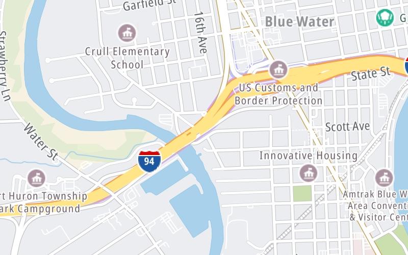
This junction is located in . NOTE: No bridge access.
This location is in the East Central Michigan area; it also overlaps with the Southwestern Ontario area.
This location's approximate GPS Coordinates are 42.99554 x -82.44329.
Which directions can I travel from here?
From this junction, traffic can only enter going westbound. Traffic can only exit going eastbound.
On to Pine Grove Ave / Hancock St, about 0.0 miles away ►
◄ Back to Water Street, about 0.5 miles away.
Which direction are tolls charged here?
Tolls are not charged or collected at this junction.
Above: Map image © TomTom Intl BVUsing The POI Map
The interactive map and lists on this page include key traveler services within two miles of this destination point.
You will find common services, including gas stations, truck stops, EV charging facilities, fast-food or family restaurants, and hotels. These are displayed on the interactive map as markers, which you can select for more information.
Current driving conditions and weather, along with a more complete list of key services, may be found below the map.


 Ambassador Bridge ▹
 Detroit Windsor Tunnel ▹
 Mackinac Bridge ▹
 Liberty Bridge ▹
 Independence Bridge ▹
 Ohio Turnpike ▹
 Indiana Toll Road ▹


