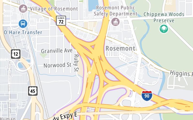
This Location At A Glance
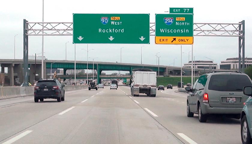
This is Exit 77/77B of the Jane Addams Memorial Tollway.
This junction is located in Des Plaines. Chicago is nearby. NOTE: SB Use Exits 77 or 78.
This location is in the Chicagoland - Northwestern Indiana area.
This location's approximate GPS Coordinates are 41.99028 x -87.86751.
Which directions can I travel from here?
From this junction, traffic can enter traveling both westbound and eastbound. Traffic can also exit traveling both westbound and eastbound.
On to Kennedy Expressway / River Road Toll Plaza, about 1.3 miles away ►
◄ Back to O'Hare / I-90 EB to I-190 WB / I-294 SB, about 0.3 miles away.
▹ The Jane Addams Memorial Tollway and the Tri State Tollway connect here.
Nearby gas and food are shown on the interactive map below.
Weather & Visibility

Cloudy
36°F / 2.5°C
Feels Like
31°F / -0.3°C

Visibility
10 Mi / 16.1 Km
3 Hr Precip
0 In / 0.0 Cm

-
NE Wind
7.2 Mi / 11.6 Km
Gusts
16.3 Mi / 26.2 Km
See the full forecast for This Location or the Chicagoland - Northwestern Indiana area
Conditions and forecasts provided in partnership with AccuWeather.

Weather provided in partnership with AccuWeather.
Available Cameras
No camera feed …
There is no currently-available traffic camera feed for this location.


 Chicago Skyway ▹
 Jane Addams Memorial Tollway ▹
 Ronald Reagan Memorial Tollway ▹
 Tri State Tollway ▹
 Veterans Memorial Tollway ▹
 Cline Avenue Bridge ▹
 Illinois Route 390 ▹
 Houbolt Road Extension ▹
 Indiana Toll Road ▹
 Ohio Turnpike ▹