Share

SR 509 Expressway At 24th Avenue South

Advertising
Advertising

About This Location

24th Avenue South
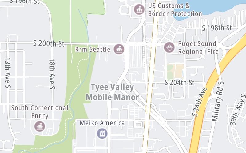
Map image © TomTom Intl BV

At A Glance

This junction is located in SeaTac. Des Moines is nearby. NOTE: also 26th Ave S.

Interactive Map Below

This location's approximate GPS Coordinates are 47.41962 x -122.30066.

Which directions can I travel from here?

From this junction, traffic can only enter going southbound. Traffic can only exit going northbound.

◄ Back to I-5, about 1.2 miles away.

Which direction are tolls charged here?

Tolls are not charged or collected at this junction.

View Map Travel Conditions

Closest Food, Gas, EV And Other Services Near 24th Avenue South

Use the map below for all services within about a two (2) mile radius.

Fuel, EV and convenience store header

Gas & EV Charging

Closest Gas Stations

76

76

20619 Military Road South • 0.62 miles

Store/Fuel Brand: 76

SAFEWAY

21401 International Boulevard • 0.73 miles

Store/Fuel Brand: Safeway

Shell

SHELL

21449 International Boulevard • 0.77 miles

Store/Fuel Brand: Shell

7-Eleven

7-ELEVEN

20008 International Boulevard • 1,524 feet

Store/Fuel Brand: 7-Eleven

View Map

Closest EV Chargers

Blink

ABBEY RIDGE APARTMENTS

3035 South 204th Street • 0.38 miles

SAFEWAY

21401 International Boulevard • 0.66 miles

Blink

HUB GARAGE

19235 International Boulevard • 0.75 miles

ChargePoint

CHARGEPOINT

3100 South 192nd Street • 0.89 miles

View Map

Coffee, snacks and dining header

Fast Food & Beverage

Closest Fast Food

Fast food refers ONLY to quick-service and take-out diners. All restaurant types are shown on the map below.

TAQUERIA EL OASIS

21449 International Boulevard • 0.77 miles

MASAE'S TERIYAKI

19021 International Boulevard • 0.91 miles

BOB'S BURGERS

20054 International Boulevard • 1,218 feet

TAQUERIA JACARANDAS

20034 International Boulevard • 1,327 feet

PIZZA TIME

20010 International Boulevard • 1,546 feet

BURGER KING

BURGER KING

21920 Pacific Highway South • 1.01 miles

KRISPY KRUNCHY CHICKEN

2841 South 188th Street • 1.03 miles

Popeyes

POPEYES

21990 Pacific Highway South • 1.04 miles

View Map

Advertising
Advertising

Interactive POI Map

The interactive map and lists on this page include key traveler services in a two-mile radius, including gas stations, truck stops, EV charging facilities, fast-food or family restaurants, and hotels.

Current driving conditions and weather, may be found below.

Advertising
Advertising

Travel Conditions At 24th Avenue South

Current Weather And Visibility

  • 08 7 12
  • °F / °C

    Feels Like:

    °F / °C

  • Visibility

    Mi / Km

    3-Hour Precip:

    In / 0.0 Cm


  • Winds ()

    MPH / KPH

    Gusts:

    MPH / KPH

▸ Get the full forecast for This Location

Available Cameras

I-5 @ 188TH ST

Camera direction: SOUTH. Seattle 98188.
Source: WSDOT.

Camera direction: SOUTH. Seattle 98188.<br />Source: WSDOT -

1.62 Mi

Camera direction: NORTH. Renton 98198.<br />Source: WSDOT -

1.82 Mi

Camera direction: SOUTH. Seattle 98032.<br />Source: WSDOT -

2.00 Mi

Camera direction: NORTH. Renton 98032.<br />Source: WSDOT -

2.11 Mi

Camera direction: SOUTH. Seattle 98188.<br />Source: WSDOT -

2.25 Mi

Advertising
Advertising

Pictures At 24th Avenue South

No photos …

There are no currently-available photos for this location.

Advertising
Advertising

Discover Washington Attractions

Hotels and destinations header

Hotels & Airports

Destination Travel

Advertising
Advertising

EXPLORE WASHINGTON

Journey to key destinations around and adjacent to Washington!

Map Of This Region ▹

Communities in this metro area include Seattle, Tacoma, Bellevue, Redmond, Kirkland, Artondale, and University Place.

Individual toll maps for this region are listed below.

Static map of Sr 509 Expressway at 24th Avenue South

Static map. Interactive map is above.

Advertising
Advertising
Turnpikes.com is proud to partner with the following: