Share

Tacoma Narrows Bridge At S 19th Street West

Advertising
Advertising

About This Location

S 19th Street West
Map image © TomTom Intl BV

At A Glance

This is Exit 2A of the Tacoma Narrows Bridge.

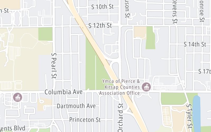
This junction is located in Tacoma.

This location is in the Seattle - Tacoma area.

Interactive Map Below

This location's approximate GPS Coordinates are 47.24565 x -122.50736.

Which directions can I travel from here?

From this junction, traffic can enter traveling both westbound and eastbound. Traffic can also exit traveling both westbound and eastbound.

On to Orchard Street / S 19th Street East, about 0.3 miles away ►

◄ Back to Pearl Street / 6th Avenue, about 0.8 miles away.

Which direction are tolls charged here?

Tolls are not charged or collected at this junction.

View Map Travel Conditions

Closest Food, Gas, EV And Other Services Near S 19th Street West

Use the map below for all services within about a two (2) mile radius.

Fuel, EV and convenience store header

Gas & EV Charging

Closest Gas Stations

FRED MEYER FUEL CENTER

4505 South 19th Street • 0.49 miles

Store/Fuel Brand:

Chevron

CHEVRON

4401 South 19th Street • 0.60 miles

Store/Fuel Brand: Chevron

7-Eleven

7-ELEVEN

5110 6th Avenue • 0.65 miles

Store/Fuel Brand: 7-Eleven

Exxon

EXXON

5015 Center Street • 0.76 miles

Store/Fuel Brand: Exxon

View Map

Closest EV Chargers

TACOMA COMMUNITY COLLEGE LOT D/E

6501 19th Street West • 0.87 miles

ChargePoint

CHARGEPOINT

6501 South 10th Street • 0.91 miles

Blink

MCLENDON HARDWARE TACOMA

1015 North Pearl Street • 0.99 miles

ALTA UNIVERSITY PLACE

2208 Mildred Street West • 1.06 miles

View Map

Coffee, snacks and dining header

Fast Food & Beverage

Closest Fast Food

Fast food refers ONLY to quick-service and take-out diners. All restaurant types are shown on the map below.

ESPRESS-O-YOURSELF

1009 Regents Boulevard • 0.61 miles

SONIC

5114 6th Avenue • 0.64 miles

CUTTERS POINT

5104 6th Avenue • 0.65 miles

FARELLI'S

6th Avenue • 0.81 miles

FLIPPING OUT BURGERS & FRIES

4008 South 12th Street • 0.83 miles

McDonald's

MCDONALD'S

4814 Center Street • 0.84 miles

Chick-fil-A

CHICK-FIL-A

6602 19th Street West • 0.86 miles

JACK IN THE BOX

4702 Center Street • 0.86 miles

View Map

Advertising
Advertising

Interactive POI Map

The interactive map and lists on this page include key traveler services in a two-mile radius, including gas stations, truck stops, EV charging facilities, fast-food or family restaurants, and hotels.

Current driving conditions and weather, may be found below.

Advertising
Advertising

Travel Conditions At S 19th Street West

Current Weather And Visibility

  • 22 7 12
  • Mostly Cloudy

    43°F / 5.9°C

    Feels Like:

    43°F / 5.9°C

  • Visibility

    8 Mi / 12.9 Km

    3-Hour Precip:

    0.01 In / 0.0 Cm

  • South Southwest
    Winds (SSW)

    5.1 MPH / 8.3 KPH

    Gusts:

    12.6 MPH / 20.2 KPH

▸ Get the full forecast for This Location | The Seattle - Tacoma area

Available Cameras

No camera feed …

There is no currently-available traffic camera feed for this location.

Advertising
Advertising

Pictures At S 19th Street West

No photos …

There are no currently-available photos for this location.

Advertising
Advertising

Discover Washington Attractions

Hotels and destinations header

Hotels & Airports

Destination Travel

Advertising
Advertising

EXPLORE WASHINGTON

Journey to key destinations around and adjacent to Washington!

Map Of This Region ▹

Communities in this metro area include Seattle, Tacoma, Bellevue, Redmond, Kirkland, Artondale, and University Place.

Individual toll maps for this region are listed below.

Static map of Tacoma Narrows Bridge at S 19th Street West

Static map. Interactive map is above.

Advertising
Advertising
Turnpikes.com is proud to partner with the following: