Share

Fort Frances Traffic And Weather

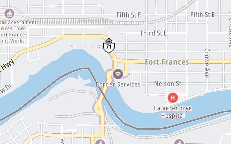
Right Now At ON 71 / Church Street and The International Bridge

Current Weather And Visibility

9:20 pm Local Time

  • 21 6 05
  • Clear

    39°F / 3.7°C

    Feels Like

    41°F / 5.1°C

  • Visibility

    20 Mi / 32.2 Km

    3 Hr Precip

    0 In / 0.0 Cm

  • NW Wind

    1.7 Mi / 2.8 Km

    Gusts

    3.8 Mi / 6.2 Km

Conditions and forecasts provided in partnership with AccuWeather.

AccuWeather logo

Weather provided in partnership with AccuWeather.

AccuWeather logo

An area traffic map, with available traffic cameras, shows driving conditions, from current traffic to mother nature's influence on the road. These follow the short-range forecasts below.

Driving Forecast Traffic Map

Static map of International Bridge at ON 71 / Church Street
Advertising

Driving Forecast For Fort Frances, At ON 71 / Church Street

Next 12 Hours

9:20 pm Local Time

Conditions and forecasts provided in partnership with AccuWeather.

AccuWeather logo

Weather provided in partnership with AccuWeather.

AccuWeather logo
Advertising

Today, Tomorrow & The Next Day

Thursday May 7

Thursday forecast: Chilly with some sun, then increasing clouds

Mostly Cloudy

5% Chance Rain

48° F/8.9° C

WNW Wind

12 to 25 Mi/

19 to 41 Km

Sunrise

5:44 AM

Thursday night: Clear to partly cloudy and cold with the temperature approaching the record low of 21 set in 2008

Partly Cloudy

1% Chance Rain

23° F/-5.0° C

WSW Wind

5 to 13 Mi/

7 to 20 Km

Sunset

8:37 PM

Friday May 8

Friday forecast: Sunshine and a few clouds

Mostly Sunny

12% Chance Rain

56° F/13.3° C

WNW Wind

8 to 23 Mi/

13 to 37 Km

Sunrise

5:43 AM

Friday night: Clear

Clear

4% Chance Rain

29° F/-1.7° C

NW Wind

6 to 17 Mi/

9 to 28 Km

Sunset

8:38 PM

Saturday May 9

Saturday forecast: Breezy and chilly with some sunshine

Partly Sunny

25% Chance Rain

47° F/8.3° C

NW Wind

13 to 29 Mi/

20 to 46 Km

Sunrise

5:41 AM

Saturday night: Partly cloudy with the temperature approaching the record low of 24 last reached in 1981

Intermittent Clouds

6% Chance Rain

26° F/-3.3° C

NW Wind

7 to 22 Mi/

11 to 35 Km

Sunset

8:39 PM

Advertising

Area Traffic Map

This junction is located in Fort Frances, at GPS 48.60899 x -93.40022. This location is in the Northeast Minnesota area.

You can pan and zoom the interactive map. Select cameras to see the on-road traffic feeds, and pick exits or other markers for conditions at those locations.

Advertising

EXPLORE MINNESOTA

Journey to key destinations around and adjacent to Minnesota!

Map Of This Region ▹

Communities in this metro area include Duluth and International Falls.

Individual toll maps for this region are listed below.

Map Of This Region ▹

Communities in this metro area include Minneapolis, St Paul, Brooklyn Park, and Maple Grove.

Individual toll maps for this region are listed below.

twin cities metro

Roads Within Region

Map Of This Region ▹

Map Of This Region ▹

Communities in this metro area include Sault Ste Marie, Thunder Bay, Fort Frances, and Greater Sudbury.

Individual toll maps for this region are listed below.

Advertising
Advertising
Turnpikes.com is proud to partner with the following: