International Bridge Traffic And Weather

Current Weather And Visibility

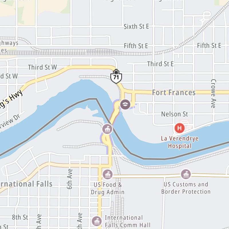
Key Regions Along The International Bridge

Northeast Minnesota

Currently Next 12 Hours

  • 0 7 04
  • Clear

    31°F

    Feels Like:

    32°F

  • Visibility

    12 Mi

    Humidity:

    84 %

  • Southeast
    Wind

    3.3 MPH

    Gusts:

    6.3 MPH

Conditions and forecasts provided in partnership with AccuWeather.

AccuWeather logo

Weather provided in partnership with AccuWeather.

AccuWeather logo
International Bridge static map

Minnesota Radar & Satellite

NOAA composite satellite & weather radar imagery.

Images from GOES-East Upper Mississippi Valley Sector. Sequence may take a moment to initialize.

  • GOES 16: GOES-East Upper Mississippi Valley Sector
  • GOES 16: GOES-East Upper Mississippi Valley Sector
  • GOES 16: GOES-East Upper Mississippi Valley Sector
  • GOES 16: GOES-East Upper Mississippi Valley Sector
  • GOES 16: GOES-East Upper Mississippi Valley Sector
  • GOES 16: GOES-East Upper Mississippi Valley Sector
  • GOES 16: GOES-East Upper Mississippi Valley Sector
  • GOES 16: GOES-East Upper Mississippi Valley Sector

Weather & Travel Conditions With The Road Map

The International Bridge is also known as Aazhogan Bridge and Fort Frances Bridge. This bridge serves International Falls and Fort Frances. Use the interactive map of the International Bridge to pick a location for destination weather.

Pan and zoom the interactive map to your chosen position. Select markers to view conditions at that location and see nearby available traffic cameras along the bridge.

View Map Regional Forecasts

Advertising
Advertising

The International Bridge Road Map

Select markers on the map for location-specific traffic and weather conditions along the International Bridge.

Advertising
Advertising

Regional Driving Forecasts For The International Bridge

Northeast Minnesota 12-Hour Forecast

1:16 am Local Time

Conditions and forecasts provided in partnership with AccuWeather.

AccuWeather logo

Weather provided in partnership with AccuWeather.

AccuWeather logo
Advertising
Advertising

EXPLORE MINNESOTA

Journey to key destinations around and adjacent to Minnesota!

Map Of This Region ▹

Communities in this metro area include Duluth and International Falls.

Individual toll maps for this region are listed below.

Map Of This Region ▹

Communities in this metro area include Minneapolis, St Paul, Brooklyn Park, and Maple Grove.

Individual toll maps for this region are listed below.

twin cities metro

Roads Within Region

Map Of This Region ▹

Map Of This Region ▹

Communities in this metro area include Sault Ste Marie, Thunder Bay, Fort Frances, and Greater Sudbury.

Individual toll maps for this region are listed below.

Advertising
Advertising
Turnpikes.com is proud to partner with the following: