Current Weather And Visibility
Key Regions Along The Richmond San Rafael Bridge
San Francisco Bay Area
Currently Next 12 Hours

Mostly Cloudy
62°F
Feels Like:
69°F
Visibility
10 Mi
Humidity:
74 %
W Wind
4 MPH
Gusts:
7.3 MPH
Conditions and forecasts provided in partnership with AccuWeather.

Weather provided in partnership with AccuWeather.
California Radar & Satellite
NOAA composite satellite & weather radar imagery.
Images from GOES-West Pacific Southwest Sector. Sequence may take a moment to initialize.
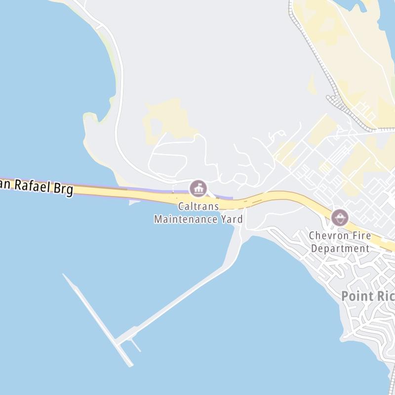
Weather & Travel Conditions With The Road Map
This bridge serves El Cerito, Richmond, and San Rafael. Use the interactive map of the Richmond San Rafael Bridge to pick a location for destination weather.
Pan and zoom the interactive map to your chosen position. Select markers to view conditions at that location and see nearby available traffic cameras along the bridge.
 CA 73 ▹
 CA 133 ▹
 CA 241 ▹
 CA 261 ▹
 Antioch Bridge ▹
 Benicia Martinez Bridge ▹
 Carquinez Bridge ▹
 Dumbarton Bridge ▹
 Golden Gate Bridge ▹
 Richmond San Rafael Bridge ▹
 San Mateo Hayward Bridge ▹
 South Bay Expressway ▹


