Wetumpka Traffic And Weather

Static map of Emerald Mountain Expressway at Rifle Range Road

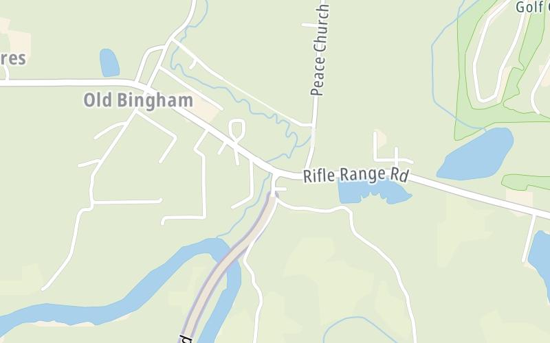
Right Now At Rifle Range Road and The Emerald Mountain Expressway

Current Weather And Visibility

2:11 pm Local Time

  • 14 6 06
  • Sunny

    89°F / 31.5°C

    Feels Like:

    102°F / 38.6°C

  • Visibility

    19 Mi / 30.6 Km

    3-Hour Precip:

    0 In / 0.0 Cm

  • West Northwest
    Winds (WNW)

    2.2 MPH / 3.6 KPH

    Gusts:

    5.6 MPH / 9 KPH

Conditions and forecasts provided in partnership with AccuWeather.

AccuWeather logo

Weather provided in partnership with AccuWeather.

AccuWeather logo

Forecast weather and driving conditions follow the jump. These include an hour-by-hour forecast for the next 12-hours, a three-day forecast and an extended forecast, for extended travel planning.

An area traffic map, with available traffic cameras, shows driving conditions, from current traffic to mother nature's influence on the road. These follow the short-range forecasts below.

Driving Forecast Traffic Map

Advertising
Advertising

Driving Forecast For Wetumpka, At Rifle Range Road

Next 12 Hours

2:11 pm Local Time

Conditions and forecasts provided in partnership with AccuWeather.

AccuWeather logo

Weather provided in partnership with AccuWeather.

AccuWeather logo

Available Cameras

No camera feed …

There is no currently-available traffic camera feed for this location.

Next Three (3) Days

Sunday June 15

Sunday forecast: Turning cloudy and humid; a thunderstorm in spots this afternoon; outdoor plans can be impacted on Father's Day

Mostly Cloudy W/ T-storms

40% Chance Rain

90° F/32.2° C

WSW Wind

5 to 9 Mi/

7 to 15 Km

Sunrise

5:37 AM

Sunday night: Turning cloudy and humid; a thunderstorm in spots this afternoon; outdoor plans can be impacted on Father's Day

Mostly Cloudy W/ T-storms

43% Chance Rain

71° F/21.7° C

S Wind

5 to 13 Mi/

7 to 20 Km

Sunset

7:53 PM

Monday June 16

Monday forecast: Humid with times of clouds and sun; a thunderstorm in spots in the afternoon

Partly Sunny W/ T-storms

40% Chance Rain

90° F/32.2° C

SSW Wind

7 to 16 Mi/

11 to 26 Km

Sunrise

5:37 AM

Monday night: Humid with times of clouds and sun; a thunderstorm in spots in the afternoon

Partly Cloudy W/ T-storms

40% Chance Rain

72° F/22.2° C

S Wind

6 to 15 Mi/

9 to 24 Km

Sunset

7:53 PM

Tuesday June 17

Tuesday forecast: Humid; cloudy in the morning, then clouds and sun in the afternoon with a thunderstorm in spots

Mostly Cloudy

40% Chance Rain

87° F/30.6° C

SSW Wind

7 to 20 Mi/

11 to 32 Km

Sunrise

5:37 AM

Tuesday night: Humid; cloudy in the morning, then clouds and sun in the afternoon with a thunderstorm in spots

Mostly Cloudy

25% Chance Rain

72° F/22.2° C

S Wind

5 to 13 Mi/

7 to 20 Km

Sunset

7:54 PM

Advertising
Advertising

Area Traffic Map

This junction is located in Wetumpka, at GPS 32.43799 x -86.12167. Montgomery is nearby. This location is in the Montgomery - South Alabama area.

You can pan and zoom the interactive map. Select cameras to see the on-road traffic feeds, and pick exits or other markers for conditions at those locations.

Advertising
Advertising

Extended Forecast For Wetumpka, At Rifle Range Road

Ten (10) Day Travel Planner

Go Online Before You Go On The Road!®

Conditions and forecasts provided in partnership with AccuWeather.

AccuWeather logo

Weather provided in partnership with AccuWeather.

AccuWeather logo
Advertising
Advertising

EXPLORE ALABAMA

Journey to key destinations around and adjacent to Alabama!

Map Of This Region ▹

Communities in this metro area include Birmingham, Tuscaloosa, Pell City, Alabaster, and Jasper.

Individual toll maps for this region are listed below.

Map Of This Region ▹

Communities in this metro area include Montgomery, Wetumpka, Autaugaville, Mt Meigs, Tuskegee, and Selma.

Individual toll maps for this region are listed below.

Map Of This Region ▹

Communities in this metro area include Mobile, Daphne, Dauphin Island, Chickasaw, and Spanish Fort.

Individual toll maps for this region are listed below.

beaches-gulf coast

Roads Within Region

Map Of This Region ▹

Map Of This Region ▹

Communities in this metro area include Destin, Pensacola Beach, Pensacola, Niceville, and Gulf Breeze.

Individual toll maps for this region are listed below.

Advertising
Advertising
Turnpikes.com is proud to partner with the following: