This Location At A Glance
This toll point is located in Garner. Raleigh is nearby. NOTE: T43 WB (Clockwise) / T44 EB (Counter clockwise).
This location is in the Raleigh - Durham area.
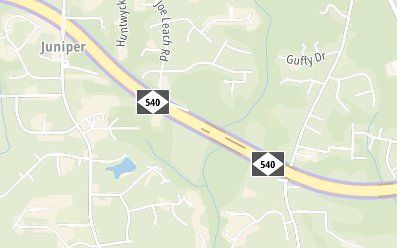
Map image © TomTom Intl BV
This location's approximate GPS Coordinates are 35.62634 x -78.62969.
On to Old Stage Road, about 2.7 miles away ►
◄ Back to N.C. 50 / Benson Road, about 1.4 miles away.
Nearby gas and food are shown on the interactive map below.
Weather & Visibility

Cloudy
57°F / 13.9°C
Feels Like
59°F / 15.1°C

Visibility
10 Mi / 16.1 Km
3 Hr Precip
0 In / 0.0 Cm

-
NW Wind
0.5 Mi / 0.9 Km
Gusts
1.8 Mi / 2.9 Km
See the full forecast for the Raleigh - Durham area
Conditions and forecasts provided in partnership with AccuWeather.

Weather provided in partnership with AccuWeather.
Available Cameras

2.66 Mi
Advertising


 Monroe Expressway ▹
 Triangle Expressway ▹
 Chesapeake Bay Bridge Tunnel ▹
 Chesapeake Expressway ▹
 Downtown Tunnel ▹
 South Norfolk Jordan Bridge ▹
 Midtown Tunnel ▹
 Dominion Boulevard Veterans Bridge ▹
 Southern Connector ▹


