This Location At A Glance
This toll point is located in Lake Park. Fairview is nearby. NOTE: M03 EB / M04WB.
This location is in the Charlotte area.
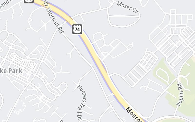
Map image © TomTom Intl BV
This location's approximate GPS Coordinates are 35.08649 x -80.61950.
On to Unionville-Indian Trail Road, about 0.8 miles away ►
◄ Back to Indian Trail-Fairview Road, about 1.4 miles away.
Nearby gas and food are shown on the interactive map below.
Weather & Visibility

Sunny
74°F / 23.3°C
Feels Like
78°F / 25.5°C

Visibility
10 Mi / 16.1 Km
3 Hr Precip
0 In / 0.0 Cm

-
WSW Wind
10.4 Mi / 16.7 Km
Gusts
10.4 Mi / 16.7 Km
See the full forecast for the Charlotte area
Conditions and forecasts provided in partnership with AccuWeather.

Weather provided in partnership with AccuWeather.
Available Cameras

0.33 Mi
0.60 Mi
0.81 Mi
1.38 Mi
1.44 Mi
Advertising


 Monroe Expressway ▹
 Triangle Expressway ▹
 Chesapeake Bay Bridge Tunnel ▹
 Chesapeake Expressway ▹
 Downtown Tunnel ▹
 South Norfolk Jordan Bridge ▹
 Midtown Tunnel ▹
 Dominion Boulevard Veterans Bridge ▹
 Southern Connector ▹


