Share

Detroit Windsor Tunnel At Jefferson Avenue

Advertising
Advertising

About This Location

Jefferson Avenue
Map image © TomTom Intl BV

At A Glance

This junction is located in Detroit. NOTE: Access point to Canada.

This location is in the Detroit - Southeast Lower Peninusula area; it also overlaps with the Southwestern Ontario area.

Interactive Map Below

This location's approximate GPS Coordinates are 42.32977 x -83.04197.

Which directions can I travel from here?

From this junction, traffic can enter traveling both southbound and northbound. Traffic can also exit traveling both southbound and northbound.

◄ Back to US Toll Plaza / Customs, about 0.1 miles away.
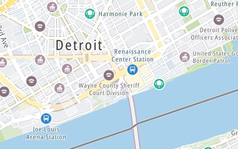
Which direction are tolls charged here?

Tolls are not charged or collected at this junction.

View Map Travel Conditions

Closest Food, Gas, EV And Other Services Near Jefferson Avenue

Use the map below for all services within about a two (2) mile radius.

Fuel, EV and convenience store header

Gas & EV Charging

Closest Gas Stations

Speedway

SPEEDWAY

711 East Jefferson Avenue • 1,776 feet

Store/Fuel Brand: Speedway

View Map

Closest EV Chargers

ChargePoint

THE Z DECK

1220 Library Street • 0.38 miles

Tesla

THE Z DECK

1220 Library Street • 0.38 miles

HUNTINGTON PLACE DETROIT EV LOT

1 Washington Boulevard • 0.38 miles

ChargePoint

CHARGEPOINT

219 Gratiot Avenue • 0.39 miles

View Map

Coffee, snacks and dining header

Fast Food & Beverage

Closest Fast Food

Fast food refers ONLY to quick-service and take-out diners. All restaurant types are shown on the map below.

PIZZAPAPALIS OF GREEKTOWN

553 Monroe Street • 0.39 miles

HELL YEAH DOG

1234 Library Street • 0.40 miles

KRISPY KRUNCHY CHICKEN

579 Monroe Street • 0.41 miles

DESSERT OASIS COFFEE ROASTERS DETROIT

1220 Griswold Street • 0.42 miles

Dunkin'

DUNKIN'

1200 Saint Antoine Street • 0.44 miles

POTBELLY

300 Renaissance Center • 1,002 feet

Cinnabon

CINNABON

901 Farmer Street • 1,038 feet

Chipotle

CHIPOTLE

630 Woodward Avenue • 1,059 feet

View Map

Advertising
Advertising

Interactive POI Map

The interactive map and lists on this page include key traveler services in a two-mile radius, including gas stations, truck stops, EV charging facilities, fast-food or family restaurants, and hotels.

Current driving conditions and weather, may be found below.

Advertising
Advertising

Travel Conditions At Jefferson Avenue

Current Weather And Visibility

  • 15 7 12
  • Snow

    29°F / -1.5°C

    Feels Like:

    31°F / -0.5°C

  • Visibility

    1 Mi / 2 Km

    3-Hour Precip:

    0.05 In / 0.1 Cm

  • Northwest
    Winds (NW)

    1.6 MPH / 2.6 KPH

    Gusts:

    3.8 MPH / 6.2 KPH

▸ Get the full forecast for This Location | The Detroit - Southeast Lower Peninusula area

Available Cameras

M-10 @ JEFFERSON AVE NB

Camera direction: NORTH. Detroit 48226.
Source: MDOT.

Camera direction: NORTH. Detroit 48226.<br />Source: MDOT -

0.35 Mi

Camera direction: EAST. Detroit 48226.<br />Source: MDOT -

0.35 Mi

Camera direction: EAST. Detroit 48226.<br />Source: MDOT -

0.40 Mi

Camera direction: SOUTH. Detroit 48226.<br />Source: MDOT -

0.40 Mi

Camera direction: SOUTH. Detroit 48226.<br />Source: MDOT -

0.41 Mi

Advertising
Advertising

Pictures At Jefferson Avenue

No photos …

There are no currently-available photos for this location.

Advertising
Advertising

Discover Michigan Attractions

Hotels and destinations header

Hotels & Airports

Destination Travel

Advertising
Advertising

EXPLORE MICHIGAN

Journey to key destinations around and adjacent to Michigan!

Map Of This Region ▹

Communities in this metro area include Detroit, Grosse Ile, Ann Arbor, Pontiac, and Lansing.

Individual toll maps for this region are listed below.

Map Of This Region ▹

Communities in this metro area include St Ignace and Sault Ste Marie.

Individual toll maps for this region are listed below.

Map Of This Region ▹

Communities in this metro area include Port Huron, Flint, Saginaw, and Bay City.

Individual toll maps for this region are listed below.

Map Of This Region ▹

Communities in this metro area include Toledo, Perrysburg, Maumee, Montpelier, and Wauseon.

Individual toll maps for this region are listed below.

Map Of This Region ▹

Communities in this metro area include Sault Ste Marie, Thunder Bay, Fort Frances, and Greater Sudbury.

Individual toll maps for this region are listed below.

Map Of This Region ▹

Communities in this metro area include Windsor.

Individual toll maps for this region are listed below.

Static map of Detroit Windsor Tunnel at Jefferson Avenue

Static map. Interactive map is above.

Advertising
Advertising
Turnpikes.com is proud to partner with the following: