Pan and zoom as desired. Tap map markers for information and to view that specific location.
Metro and regional information is below. You will also find a list of exits and other points-of-interest in the Baltimore area. Exit lists below are sorted by the name of the toll road.
				The Baltimore area includes the following cities: Baltimore, Edgewood, Columbia, Laurel, and Gaithersburg.
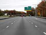
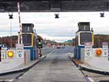
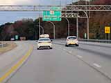
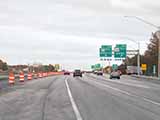
The interactive metro/regional map above shows exits and toll points for each toll road that is in, or crosses into, the Baltimore area.
Markers can be selected for a map of that specific exit, toll gantry or other point of interest. Exit maps will show you nearby dining, gas, EV charging, hotels and other services.
The following (8) toll roads are in this area, cross through this area or connect with this region:
Selecting a road will reveal a map of that toll road.
Turnpikes.com has partnered with Tiqets.com to bring you these excusive deals on attractions!
A list of all exits and other points-of-interest in this region, sorted by toll road.
Exit 32Oceanic Road — Annapolis
▸ GPS 39.019778000 X -76.414542000 
NOTES: 
 Maryland Transportation Authority manages this segment.
Bay Bridge Toll Plaza — Annapolis
▸ GPS 39.013028000 X -76.407400000 
NOTES: 
 Maryland Transportation Authority manages this segment.
Exit 37Romancoke Road — Stevensville
▸ GPS 38.980389000 X -76.328114000 
NOTES: 
 Maryland Transportation Authority manages this segment.
Exit 55Key Highway (McComas St) — Baltimore
▸ GPS 39.265517000 X -76.593027000 
NOTES: Fort McHenry Nat'l Monument
 Maryland Transportation Authority manages this segment.
Fort McHenry Tunnel Tolls — Baltimore
▸ GPS 39.266293000 X -76.562084000 
NOTES: 
 Maryland Transportation Authority manages this segment.
Exit 56Keith Avenue — Baltimore
▸ GPS 39.266786000 X -76.561392000 
NOTES: 
 Maryland Transportation Authority manages this segment.
Exit 43Bethlehem Blvd / Peninsula Expressway — Edgemere
▸ GPS 39.238384000 X -76.478441000 
NOTES: 
 Maryland Transportation Authority manages this segment.
Exit 44Broening Highway — Dundalk
▸ GPS 39.232036000 X -76.506781000 
NOTES: 
 Maryland Transportation Authority manages this segment.
Exit 1MD 173/Hawkins Point Rd — Baltimore
▸ GPS 39.204987000 X -76.565511000 
NOTES: 
 Maryland Transportation Authority manages this segment.
Exit 8A/8BHanover Street / Shell Road — Baltimore
▸ GPS 39.241001000 X -76.592827000 
NOTES: 
 Maryland Transportation Authority manages this segment.
Baltimore Harbor Tunnel Thruway Tolls — Baltimore
▸ GPS 39.240914000 X -76.587198000 
NOTES: 
 Maryland Transportation Authority manages this segment.
Exit 10Holabird Ave — Baltimore
▸ GPS 39.271976000 X -76.554688000 
NOTES: NB Exit Only
 Maryland Transportation Authority manages this segment.
Exit 11A/11BO'Donnell Street — Baltimore
▸ GPS 39.280915000 X -76.553233000 
NOTES: 
 Maryland Transportation Authority manages this segment.
I–270 / Sam Eig Highway — Gaithersburg
▸ GPS 39.121466000 X -77.197868000 
NOTES: 
 Maryland Transportation Authority manages this segment.
Exit 2MD 355/Frederick Road — Gaithersburg
▸ GPS 39.122978000 X -77.178318000 
NOTES: 
 Maryland Transportation Authority manages this segment.
Exit 3AShady Grove Road — Redland
▸ GPS 39.129015000 X -77.172364000 
NOTES: EB Exit
 Maryland Transportation Authority manages this segment.
Exit 3BMetro Station — Redland
▸ GPS 39.131330000 X -77.170092000 
NOTES: EB Exit
 Maryland Transportation Authority manages this segment.
Exit 3Shady Grove Rd / Metro Stn — Redland
▸ GPS 39.133652000 X -77.168277000 
NOTES: WB Exits
 Maryland Transportation Authority manages this segment.
Exit 8A/8BGeorgia Avenue/MD 97 — Olney
▸ GPS 39.118197000 X -77.074944000 
NOTES: 
 Maryland Transportation Authority manages this segment.
Exit 10Layhill Road/MD 182 — Aspen Hill
▸ GPS 39.099383000 X -77.042215000 
NOTES: 
 Maryland Transportation Authority manages this segment.
Exit 13New Hampshire Avenue/MD 650 — Colesville
▸ GPS 39.088261000 X -76.999528000 
NOTES: 
 Maryland Transportation Authority manages this segment.
Exit 16A/16BUS 29/Columbia Pike — Silver Spring
▸ GPS 39.077804000 X -76.952686000 
NOTES: 
 Maryland Transportation Authority manages this segment.
Exit 17Briggs Chaney Road — Fairland
▸ GPS 39.073665000 X -76.939327000 
NOTES: 
 Maryland Transportation Authority manages this segment.
Exit 19A/19BI–95 — Calverton
▸ GPS 39.073622000 X -76.905912000 
NOTES: 
 Maryland Transportation Authority manages this segment.
Exit 19Cto MD 198 — Calverton
▸ GPS 39.073500000 X -76.905300000 
NOTES: 
 Maryland Transportation Authority manages this segment.
Exit 20Konterra Drive — Beltsville
▸ GPS 39.067479000 X -76.889327000 
NOTES: 
 Maryland Transportation Authority manages this segment.
US Hwy 1/Baltimore Avenue — Laurel
▸ GPS 39.065330000 X -76.881510000 
NOTES: 
 Maryland Transportation Authority manages this segment.
Exit 64/64AI–695 / Baltimore Beltway — Rosedale
▸ GPS 39.350440000 X -76.495719000 
NOTES: 
 Maryland Transportation Authority manages this segment.
Exit 67MD 43 / White Marsh Blvd — Nottingham
▸ GPS 39.379154000 X -76.448472000 
NOTES: 
 Maryland Transportation Authority manages this segment.
Exit 74MD 152 / Mountain Road — Joppatowne
▸ GPS 39.441906000 X -76.348455000 
NOTES: to Gunpowder Falls State Park
 Maryland Transportation Authority manages this segment.
Exit 77A/77BMD 24 / Veterans Mem Hwy — Bel Air
▸ GPS 39.456785000 X -76.310036000 
NOTES: to MD 924
 Maryland Transportation Authority manages this segment.
Exit 80MD 543 / Riverside Parkway — Belcamp
▸ GPS 39.484197000 X -76.251363000 
NOTES: Belcamp / South Bel Air
 Maryland Transportation Authority manages this segment.
Maryland House Travel Plaza — North East
▸ GPS 39.496640000 X -76.233187000 
NOTES: 
Exit 85MD 22 / Aberdeen Thruway — Aberdeen
▸ GPS 39.526406000 X -76.191704000 
NOTES: 
 Maryland Transportation Authority manages this segment.
Exit 89MD 155 / Level Road — Havre De Grace
▸ GPS 39.571243000 X -76.137589000 
NOTES: Havre de Grace
 Maryland Transportation Authority manages this segment.
Tydings Bridge Toll Gantry — Perryville
▸ GPS 39.588576000 X -76.072322000 
NOTES: Gantry has replaced the old plaza.
 Maryland Transportation Authority manages this segment.
Exit 93MD 222 — Perryville
▸ GPS 39.593091000 X -76.066353000 
NOTES: Perryville
 Maryland Transportation Authority manages this segment.
Chesapeake House Travel Plaza — North East
▸ GPS 39.611788000 X -76.009365000 
NOTES: 
Exit 100MD 272 / North East Road — North East
▸ GPS 39.631906000 X -75.956700000 
NOTES: to Elk Neck State Park
 Maryland Transportation Authority manages this segment.
Exit 109MD 279 / Elkton Road — Elkton
▸ GPS 39.640824000 X -75.802145000 
NOTES: 
 Maryland Transportation Authority manages this segment.
Delaware state line — Elkton
▸ GPS 39.638732000 X -75.787768000 
NOTES: Delaware Turnpike
 Maryland Transportation Authority manages this segment.
Havre de Grace — Havre De Grace
▸ GPS 39.554142000 X -76.101003000 
NOTES: Ontario Street
 Maryland Transportation Authority manages this segment.
Bridge Toll Plaza and MDTA Administration — Perryville
▸ GPS 39.568186000 X -76.073245000 
NOTES: 
 Maryland Transportation Authority manages this segment.
Perryville — Perryville
▸ GPS 39.569473000 X -76.070326000 
NOTES: Perryville Rd/Aiken Ave
 Maryland Transportation Authority manages this segment.
						We have partnered with Hotels.com to help you get the best deal on hotels.
						We have partnered with Tiqets to bring you deals on dining and attractions.
Journey to key destinations around and adjacent to Maryland!
Communities in this metro area include Baltimore, Edgewood, Columbia, Laurel, and Gaithersburg.
Individual toll maps for this region are listed below.
Communities in this metro area include Washington, Dc, Fairfax County, Virginia, Loundoun County, Virginia, Montgomery County, Maryland, and Prince George's County, Maryland.
Individual toll maps for this region are listed below.
Communities in this metro area include Wilmington, Middletown, Newark, and Carneys Point, New Jersey.
Individual toll maps for this region are listed below.