This Location At A Glance
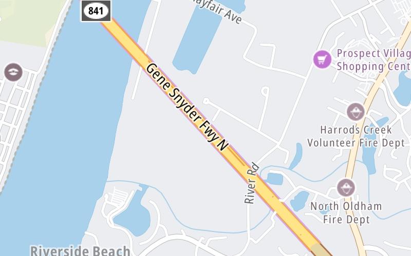
This toll point is located in Louisville. NOTE: Toll gantry on Kentucky side of Ohio River, between tunnel and bridge span.
This location is in the Louisville - Southern Indiana area.
This location's approximate GPS Coordinates are 38.33537 x -85.63475.
On to Old Salem Road, about 2.3 miles away ►
◄ Back to Gene Snyder Fwy at I–71, about 3.1 miles away.
This location also connects with Indiana.
Nearby gas and food are shown on the interactive map below.
Weather & Visibility

Mostly Cloudy
54°F / 12.5°C
Feels Like
61°F / 15.8°C

Visibility
12 Mi / 19.3 Km
3 Hr Precip
0 In / 0.0 Cm

-
W Wind
3.5 Mi / 5.6 Km
Gusts
9 Mi / 14.5 Km
See the full forecast for the Louisville - Southern Indiana area
Conditions and forecasts provided in partnership with AccuWeather.

Weather provided in partnership with AccuWeather.
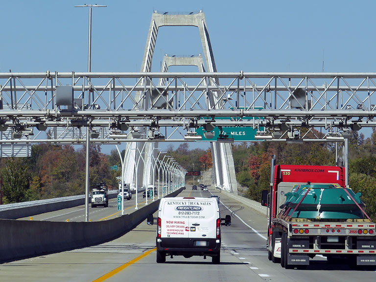
Available Cameras

146 Ft
0.38 Mi
0.51 Mi
0.71 Mi
1.20 Mi


 Lewis And Clark Bridge ▹
 Abraham Lincoln Bridge ▹