Interstate 75 At KY 627 (Boonesborough Road)

Advertising
Advertising

Map & services within two (2) miles

Interactive map shows available cameras, plus nearby fuel, food and lodging

See below for more about this area

Advertising
Advertising

About This Location

KY 627 (Boonesborough Road)

At A Glance

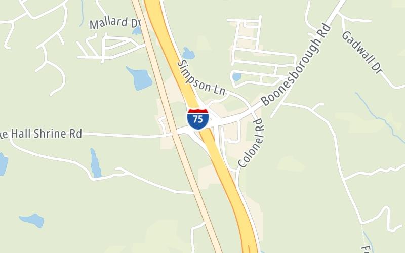
This is Exit 95 of I-75.

This surface highway is located in Richmond.

This location's approximate GPS Coordinates are 37.84349 x -84.32718.

View Map Travel Conditions

Above: Map image © TomTom Intl BV

Using The POI Map

The interactive map above and lists on this page below include key traveler services within two miles of this location.

You will find common services, including gas stations, truck stops, EV charging facilities, fast-food or family restaurants, and hotels. These are displayed on the interactive map as markers, which you can select for more information.

Current weather and driving conditions may be found below.

View Map Weather

Advertising
Advertising

Travel Conditions At KY 627 (Boonesborough Road)

Current Weather And Visibility

  • 18 6 06
  • Partly Sunny

    88°F / 31°C

    Feels Like:

    96°F / 35.6°C

  • Visibility

    19 Mi / 30.6 Km

    3-Hour Precip:

    0 In / 0.0 Cm

  • South
    Winds (S)

    4.5 MPH / 7.3 KPH

    Gusts:

    8.9 MPH / 14.3 KPH

▸ Get the full forecast for This Location

Available Cameras

I-75 @ MADISON COUNTY SB

I-75 @ MADISON COUNTY SB

Camera Direction: UNKNOWN. Source: TRIMARC - undetermined 40475

Cameras Closest To KY 627 (Boonesborough Road)

Camera Direction: UNKNOWN. Source: TRIMARC - undetermined 40475

1.29 Mi

Camera Direction: UNKNOWN. Source: TRIMARC - undetermined 40475

1.29 Mi

Camera Direction: UNKNOWN. Source: TRIMARC - undetermined 40475

1.98 Mi

Camera Direction: UNKNOWN. Source: TRIMARC - undetermined 40475

1.98 Mi

Camera Direction: NORTH. Source: TRIMARC - Lexington 40475

2.73 Mi

Advertising
Advertising

Travel Pictures

No photos …

There are no currently-available photos for this location.

Advertising
Advertising

Closest Food, Gas, EV And Other Services Near KY 627 (Boonesborough Road)

The map above shows all services within about a two (2) mile radius.

Hotels and destinations header

Hotels & Airports

Destination Travel

Fuel, EV and convenience store header

Gas & EV Charging

Closest Gas Stations

HARDY OIL CO

3022 Simpson Lane • 642 feet

Store/Fuel Brand:

Shell

DISHMANS SHELL FOOD

3198 Lexington Road • 872 feet

Store/Fuel Brand: Shell

View Map ▴

Closest EV Chargers

View Map ▴

No EV charging stations nearby.

Coffee, snacks and dining header

Fast Food & Beverage

Closest Fast Food

Fast food refers ONLY to quick-service and take-out diners. All restaurant types are shown on the map below.

Arby's

ARBY'S

3799 Colonel Road • 792 feet

HUNT BROTHERS PIZZA

3198 Lexington Road • 918 feet

View Map ▴

Discover Kentucky Attractions

Turnpikes.com has partnered with Tiqets.com to bring you these vacation values!

Advertising
Advertising

EXPLORE KENTUCKY

Journey to key destinations around and adjacent to Kentucky!

Map Of This Region ▹

Communities in this metro area include Louisville and Jeffersonville, Indiana.

Individual toll maps for this region are listed below.

Map Of This Region ▹

Communities in this metro area include Cincinnati, Norwood, Cheviot, Northbrook, Reading, Covington, Kentucky, and Newport, Kentucky.

Individual toll maps for this region are listed below.

cincinnati-covington

Roads Within Region

Map Of This Region ▹

Advertising
Advertising
Turnpikes.com is proud to partner with the following: