Interstate 90 At IL 19 (Irving Park Road) / Pulaski Road

Advertising
Advertising

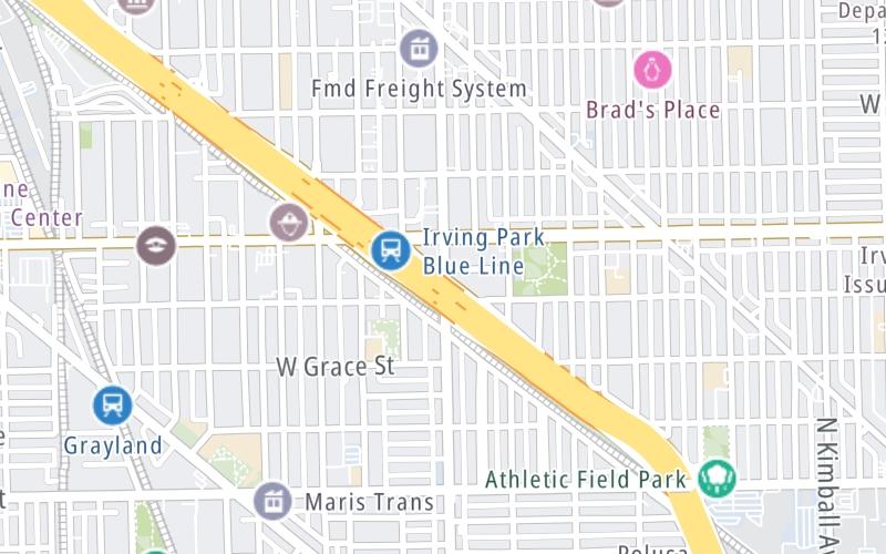
Map & services within two (2) miles

Interactive map shows available cameras, plus nearby fuel, food and lodging

See below for more about this area

Advertising
Advertising

About This Location

 IL 19 (Irving Park Road) / Pulaski Road

At A Glance

This is Exit 44B of I-90.

This surface highway is located in the Chicagoland - Northwestern Indiana area. You will find Chicago, Aurora, Oak Lawn, Des Plaines, Waukegan, Highland Park, Gary, Indiana, Schaumburg, Naperville, Oak Brook, and Joliet in this region.

This location's approximate GPS Coordinates are 41.95253 x -87.72759.

View Map Travel Conditions

Above: Map image © TomTom Intl BV

Using The POI Map

The interactive map above and lists on this page below include key traveler services within two miles of this location.

You will find common services, including gas stations, truck stops, EV charging facilities, fast-food or family restaurants, and hotels. These are displayed on the interactive map as markers, which you can select for more information.

Current weather and driving conditions may be found below.
View Map Weather

Advertising
Advertising

Travel Conditions At IL 19 (Irving Park Road) / Pulaski Road

Current Weather And Visibility

  • 03 7 04
  • Clear

    51°F / 10.4°C

    Feels Like:

    53°F / 11.4°C

  • Visibility

    10 Mi / 16.1 Km

    3-Hour Precip:

    0 In / 0.0 Cm

  • East
    Winds (E)

    1.6 MPH / 2.6 KPH

    Gusts:

    4.5 MPH / 7.3 KPH

▸ Get the full forecast for This Location | The Chicagoland - Northwestern Indiana area

Available Cameras

No camera feed …

There is no currently-available traffic camera feed for this location.

Advertising
Advertising

Travel Pictures

No photos …

There are no currently-available photos for this location.

Advertising
Advertising

Closest Food, Gas, EV And Other Services Near IL 19 (Irving Park Road) / Pulaski Road

The map above shows all services within about a two (2) mile radius.

Hotels and destinations header

Hotels & Airports

Destination Travel

Fuel, EV and convenience store header

Gas & EV Charging

Closest Gas Stations

Shell

SHELL

3700 West Addison Street • 0.55 miles

Store/Fuel Brand: Shell

BP

BP

4359 North Pulaski Road • 0.57 miles

Store/Fuel Brand: BP

Citgo

CITGO

4603 North Pulaski Road • 0.85 miles

Store/Fuel Brand: Citgo

BP

BELMONT AND PULASKI BP

3968 West Belmont Avenue • 0.91 miles

Store/Fuel Brand: BP

View Map ▴Full List ▾

Closest EV Chargers

BERMAN SUBARU OF CHICAGO - NON-NETWORKED

4330 West Irving Park Road • 0.50 miles

CONNECTOR: IEC62196Type1
POWER: 7 KW @ 208 V
CURRENT: 50 Amp AC1

CLARENDALE SIX CORNERS

3955 North Milwaukee Avenue • 0.95 miles

CONNECTOR: IEC62196Type1
POWER: 6 KW @ 240 V
CURRENT: 27 Amp AC1

BERMAN NISSAN - CHICAGO

3456 North Kedzie Avenue • 1.17 miles

CONNECTOR: IEC62196Type1
POWER: 7 KW @ 240 V
CURRENT: 30 Amp AC1

View Map ▴

Coffee, snacks and dining header

Fast Food & Beverage

Closest Fast Food

Fast food refers ONLY to quick-service and take-out diners. All restaurant types are shown on the map below.

McDonald's

MCDONALD'S

3615 West Irving Park Road • 0.48 miles

BUONA

3608 West Irving Park Road • 0.49 miles

NATURAL JUICES

4343 North Elston Avenue • 0.51 miles

JERSEY MIKE'S SUBS

4359 West Irving Park Road • 0.52 miles

SUSIE'S DRIVE-THRU

4126-28 West Montrose Avenue • 0.62 miles

Wendy's

WENDY'S

4412 North Pulaski Road • 0.62 miles

LITTLE CAESARS

4445 North Pulaski Road • 0.65 miles

Wingstop

WINGSTOP

4445 North Pulaski Road • 0.66 miles

View Map ▴Full List ▾

Discover Illinois Attractions

Turnpikes.com has partnered with Tiqets.com to bring you these vacation values!

Advertising
Advertising

EXPLORE ILLINOIS

Journey to key destinations around and adjacent to Illinois!

Map Of This Region ▹

Communities in this metro area include Chicago, Aurora, Oak Lawn, Des Plaines, Waukegan, Highland Park, Gary, Indiana, Schaumburg, Naperville, Oak Brook, and Joliet.

Individual toll maps for this region are listed below.

Map Of This Region ▹

Communities in this metro area include Gary, South Bend, Elkhart, Portage, and Fremont.

Individual toll maps for this region are listed below.

Advertising
Advertising
Turnpikes.com is proud to partner with the following: