This Location At A Glance
This is Exit 7/7B of the Richmond San Rafael Bridge.
This junction is located in Richmond.
This location is in the San Francisco Bay Area area.
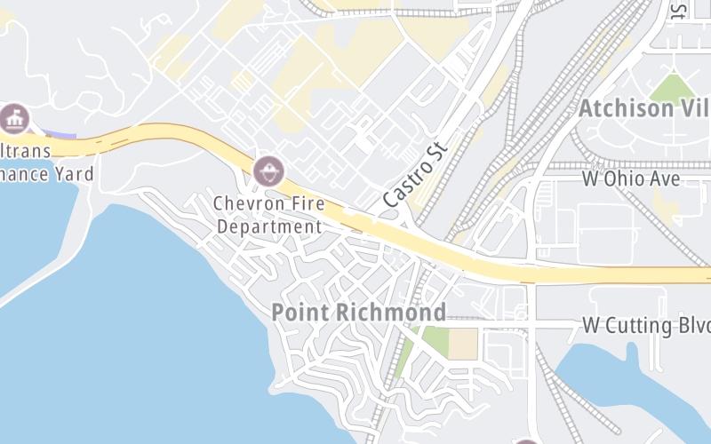
This location's approximate GPS Coordinates are 37.92914 x -122.38668.
Which directions can I travel from here?
From this junction, traffic can enter traveling both westbound and eastbound. Traffic can also exit traveling both westbound and eastbound.
On to Canal Boulevard / Richmond Parkway, about 0.4 miles away ►
◄ Back to Stenmark Drive / to Point Molate, about 0.7 miles away.
Nearby gas and food are shown on the interactive map below.
Weather & Visibility

Mostly Cloudy
63°F / 17.3°C
Feels Like
63°F / 17.4°C

Visibility
13 Mi / 20.9 Km
3 Hr Precip
0 In / 0.0 Cm

-
WSW Wind
3.4 Mi / 5.5 Km
Gusts
6.2 Mi / 10 Km
See the full forecast for This Location or the San Francisco Bay Area area
Conditions and forecasts provided in partnership with AccuWeather.

Weather provided in partnership with AccuWeather.
Available Cameras

0.80 Mi
1.02 Mi
1.37 Mi
1.73 Mi
2.12 Mi

 CA 73 ▹
 CA 133 ▹
 CA 241 ▹
 CA 261 ▹
 Antioch Bridge ▹
 Benicia Martinez Bridge ▹
 Carquinez Bridge ▹
 Dumbarton Bridge ▹
 Golden Gate Bridge ▹
 Richmond San Rafael Bridge ▹
 San Mateo Hayward Bridge ▹
 South Bay Expressway ▹


