This Location At A Glance
NOTICE! Data for this plaza/rest stop is being updated.
This rest stop is located in Fort Baker. Sausalito is nearby.
This location is in the San Francisco Bay Area area.
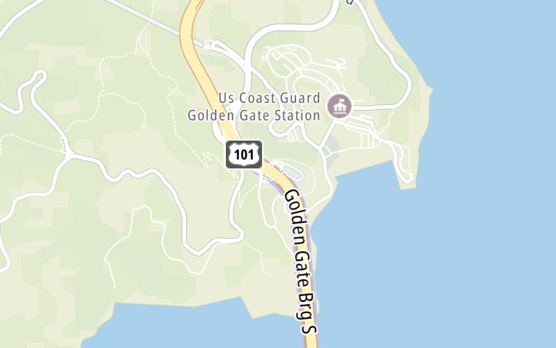
Map image © TomTom Intl BV
This location's approximate GPS Coordinates are 37.83271 x -122.48114.
On to Alexander Avenue / Fort Baker, about 0.2 miles away ►
◄ Back to Golden Gate Bridge Welcome Center, about 1.9 miles away.
Nearby gas and food are shown on the interactive map below.
Weather & Visibility

Clear
53°F / 11.5°C
Feels Like
53°F / 11.7°C

Visibility
8 Mi / 12.9 Km
3 Hr Precip
0 In / 0.0 Cm

-
SSW Wind
3.3 Mi / 5.4 Km
Gusts
5.4 Mi / 8.7 Km
See the full forecast for the San Francisco Bay Area area
Conditions and forecasts provided in partnership with AccuWeather.

Weather provided in partnership with AccuWeather.
Available Cameras

1.34 Mi
Advertising

 CA 73 ▹
 CA 133 ▹
 CA 241 ▹
 CA 261 ▹
 Antioch Bridge ▹
 Benicia Martinez Bridge ▹
 Carquinez Bridge ▹
 Dumbarton Bridge ▹
 Golden Gate Bridge ▹
 Richmond San Rafael Bridge ▹
 San Mateo Hayward Bridge ▹
 South Bay Expressway ▹


