This Location At A Glance
This junction is located in Rio Vista.
This location is in the San Francisco Bay Area area.
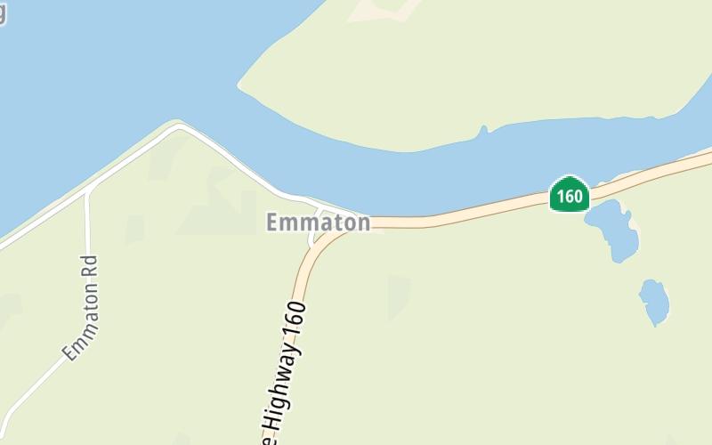
This location's approximate GPS Coordinates are 38.08013 x -121.73034.
Which directions can I travel from here?
From this junction, traffic can enter traveling both southbound and northbound. Traffic can also exit traveling both southbound and northbound.
On to Three Mile Slough Bridge / East Levee Rd, about 2.5 miles away ►
◄ Back to Sherman Island Cross Road, about 1.7 miles away.
Nearby gas and food are shown on the interactive map below.
Weather & Visibility

Clear
69°F / 20.3°C
Feels Like
66°F / 19°C

Visibility
15 Mi / 24.1 Km
3 Hr Precip
0 In / 0.0 Cm

-
WSW Wind
5.7 Mi / 9.2 Km
Gusts
10.8 Mi / 17.4 Km
See the full forecast for This Location or the San Francisco Bay Area area
Conditions and forecasts provided in partnership with AccuWeather.

Weather provided in partnership with AccuWeather.
Available Cameras
No camera feed …
There is no currently-available traffic camera feed for this location.

 CA 73 ▹
 CA 133 ▹
 CA 241 ▹
 CA 261 ▹
 Antioch Bridge ▹
 Benicia Martinez Bridge ▹
 Carquinez Bridge ▹
 Dumbarton Bridge ▹
 Golden Gate Bridge ▹
 Richmond San Rafael Bridge ▹
 San Mateo Hayward Bridge ▹
 South Bay Expressway ▹


