Piedmont Traffic And Weather

Static map of Southern Connector at US Hwy 25

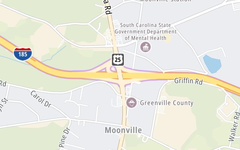
Right Now At US Hwy 25 and The Southern Connector

Current Weather And Visibility

7:12 pm Local Time

  • 19 6 08
  • Cloudy

    66°F / 18.9°C

    Feels Like:

    63°F / 17.5°C

  • Visibility

    10 Mi / 16.1 Km

    3-Hour Precip:

    0.05 In / 0.1 Cm

  • North Northeast
    Winds (NNE)

    9.2 MPH / 14.8 KPH

    Gusts:

    9.2 MPH / 14.8 KPH

Conditions and forecasts provided in partnership with AccuWeather.

AccuWeather logo

Weather provided in partnership with AccuWeather.

AccuWeather logo

Forecast weather and driving conditions follow the jump. These include an hour-by-hour forecast for the next 12-hours, a three-day forecast and an extended forecast, for extended travel planning.

An area traffic map, with available traffic cameras, shows driving conditions, from current traffic to mother nature's influence on the road. These follow the short-range forecasts below.

Driving Forecast Traffic Map

Advertising
Advertising

Driving Forecast For Piedmont, At US Hwy 25

Next 12 Hours

7:12 pm Local Time

Conditions and forecasts provided in partnership with AccuWeather.

AccuWeather logo

Weather provided in partnership with AccuWeather.

AccuWeather logo

Available Cameras

No camera feed …

There is no currently-available traffic camera feed for this location.

Next Three (3) Days

Sunday August 3

Sunday forecast: Overcast; breezy this morning with brief showers followed by rain this afternoon

Rain

100% Chance Rain

71° F/21.7° C

NE Wind

10 to 16 Mi/

17 to 26 Km

Sunrise

6:41 AM

Sunday night: Overcast; breezy this morning with brief showers followed by rain this afternoon

Mostly Cloudy W/ Showers

80% Chance Rain

65° F/18.3° C

NE Wind

7 to 17 Mi/

11 to 28 Km

Sunset

8:30 PM

Monday August 4

Monday forecast: Intervals of clouds and sun with a couple of heavy thunderstorms in the afternoon

Partly Sunny W/ T-storms

70% Chance Rain

73° F/22.8° C

ENE Wind

8 to 22 Mi/

13 to 35 Km

Sunrise

6:42 AM

Monday night: Intervals of clouds and sun with a couple of heavy thunderstorms in the afternoon

Thunderstorms

98% Chance Rain

64° F/17.8° C

NNE Wind

7 to 17 Mi/

11 to 28 Km

Sunset

8:29 PM

Tuesday August 5

Tuesday forecast: Cloudy with a couple of showers and a heavy thunderstorm; watch for flash flooding

Thunderstorms

95% Chance Rain

75° F/23.9° C

NE Wind

8 to 21 Mi/

13 to 33 Km

Sunrise

6:42 AM

Tuesday night: Cloudy with a couple of showers and a heavy thunderstorm; watch for flash flooding

Thunderstorms

87% Chance Rain

66° F/18.9° C

NNE Wind

7 to 18 Mi/

11 to 30 Km

Sunset

8:29 PM

Advertising
Advertising

Area Traffic Map

This junction is located in Piedmont, at GPS 34.72349 x -82.38806. Greenville is nearby. This location is in the Greenville - Spartanburg area.

You can pan and zoom the interactive map. Select cameras to see the on-road traffic feeds, and pick exits or other markers for conditions at those locations.

Advertising
Advertising

Extended Forecast For Piedmont, At US Hwy 25

Ten (10) Day Travel Planner

Go Online Before You Go On The Road!®

Conditions and forecasts provided in partnership with AccuWeather.

AccuWeather logo

Weather provided in partnership with AccuWeather.

AccuWeather logo
Advertising
Advertising

EXPLORE SOUTH CAROLINA

Journey to key destinations around and adjacent to South Carolina!

Map Of This Region ▹

Communities in this metro area include Greenville, Spartanburg, Piedmont, Simpsonville, Anderson, and Asheville, North Carolina.

Individual toll maps for this region are listed below.

Map Of This Region ▹

Communities in this metro area include Columbia, West Columbia, Forest Acres, Orangeburg, Sumter, and Newberry.

Individual toll maps for this region are listed below.

greater columbia-state capitol

Roads Within Region

Map Of This Region ▹

Map Of This Region ▹

Communities in this metro area include Myrtle Beach, Carolina Forest, Arcadian Shores, North Myrtle Beach, Surfside Beach, and Murrells Inlet.

Individual toll maps for this region are listed below.

myrtle beach

Roads Within Region

Map Of This Region ▹

Map Of This Region ▹

Communities in this metro area include Charleston, Isle Of Palms, Kiawah Island, Johns Island, Folly Beach, North Charleston, and Goose Creek.

Individual toll maps for this region are listed below.

charleston

Roads Within Region

Map Of This Region ▹

Map Of This Region ▹

Communities in this metro area include Charlotte, Wesley Chapel, Monroe, Unionville, and Fairview.

Individual toll maps for this region are listed below.

Advertising
Advertising
Turnpikes.com is proud to partner with the following: