Travel Conditions In South Carolina's Capital Area
4:40 pm Local Time
Light Rain
52°F / 10.9°C
Feels Like
50°F / 10°C
Visibility
3 Mi / 4.8 Km
3 Hr Precip
0.13 In / 0.3 Cm
SW Wind
2.6 Mi / 4.3 Km
Gusts
6 Mi / 9.6 Km
More Weather Options
Includes the following communities: Greenville, Spartanburg, Piedmont, Simpsonville, Anderson, and Asheville, North Carolina.
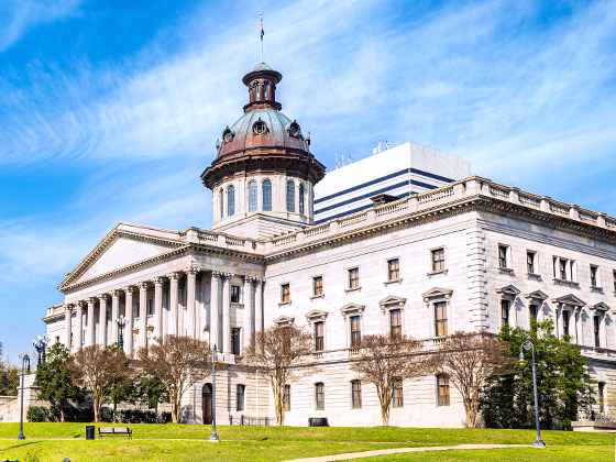
Includes the following communities: Columbia, West Columbia, Forest Acres, Orangeburg, Sumter, and Newberry.
NOAA composite satellite & radar imagery.
Images from GOES-East Southeast Sector. Sequence may take a moment to load.
More Weather Options
Select any metro area for regional weather. Select individual roads to view weather for that road by itself.
Note that state-wide toll roads will cross multiple regions; therefore, you may see multiple instances of the same road across all regions.
Simply scroll and tap the shield for the interstate you want. We are just beginning to add this data.
Journey to key destinations around and adjacent to South Carolina!
Communities in this metro area include Greenville, Spartanburg, Piedmont, Simpsonville, Anderson, and Asheville, North Carolina.
Individual toll maps for this region are listed below.
Communities in this metro area include Columbia, West Columbia, Forest Acres, Orangeburg, Sumter, and Newberry.
Individual toll maps for this region are listed below.
Roads Within Region
Communities in this metro area include Myrtle Beach, Carolina Forest, Arcadian Shores, North Myrtle Beach, Surfside Beach, and Murrells Inlet.
Individual toll maps for this region are listed below.
Roads Within Region
Communities in this metro area include Charleston, Isle Of Palms, Kiawah Island, Johns Island, Folly Beach, North Charleston, and Goose Creek.
Individual toll maps for this region are listed below.
Roads Within Region
Communities in this metro area include Charlotte, Wesley Chapel, Monroe, Unionville, and Fairview.
Individual toll maps for this region are listed below.