Bridge Of The Gods Traffic And Weather

Current Weather And Visibility

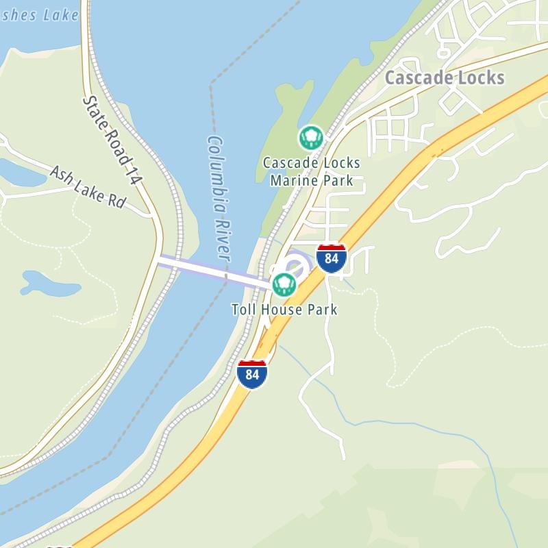
Key Regions Along The Bridge Of The Gods

Conditions and forecasts provided in partnership with AccuWeather.

AccuWeather logo

Weather provided in partnership with AccuWeather.

AccuWeather logo
Bridge Of The Gods static map

Oregon Radar & Satellite

NOAA composite satellite & weather radar imagery.

Images from GOES-West Pacific Northwest Sector. Sequence may take a moment to initialize.

  • GOES 18: GOES-West Pacific Northwest Sector
  • GOES 18: GOES-West Pacific Northwest Sector
  • GOES 18: GOES-West Pacific Northwest Sector
  • GOES 18: GOES-West Pacific Northwest Sector
  • GOES 18: GOES-West Pacific Northwest Sector
  • GOES 18: GOES-West Pacific Northwest Sector
  • GOES 18: GOES-West Pacific Northwest Sector
  • GOES 18: GOES-West Pacific Northwest Sector

Weather & Travel Conditions With The Road Map

This bridge serves Cascade Locks and Stevenson. Use the interactive map of the Bridge Of The Gods to pick a location for destination weather.

Pan and zoom the interactive map to your chosen position. Select markers to view conditions at that location and see nearby available traffic cameras along the bridge.

View Map Regional Forecasts

Advertising
Advertising

The Bridge Of The Gods Road Map

Select markers on the map for location-specific traffic and weather conditions along the Bridge Of The Gods.

Advertising
Advertising

Travel Alerts

No alerts to display at this time.

Advertising
Advertising

EXPLORE OREGON

Journey to key destinations around and adjacent to Oregon!

Advertising
Advertising
Turnpikes.com is proud to partner with the following: