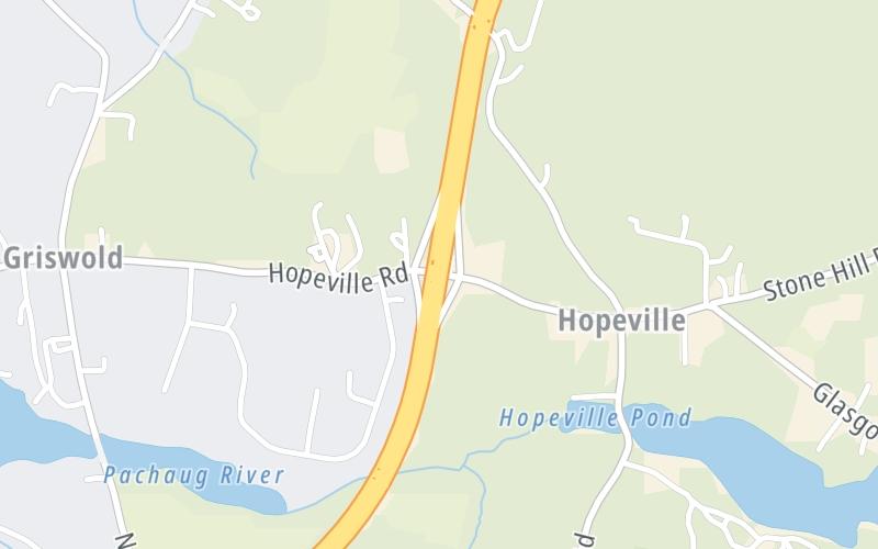
7:27 am Local Time
Cloudy
62°F / 16.9°C
Feels Like:
65°F / 18.2°C
Visibility
14 Mi / 22.5 Km
3-Hour Precip:
0 In / 0.0 Cm
West
Winds (W)
3.2 MPH / 5.2 KPH
Gusts:
15.3 MPH / 24.7 KPH
Forecast weather and driving conditions follow the jump. These include an hour-by-hour forecast for the next 12-hours, a three-day forecast and an extended forecast, for extended travel planning.
An area traffic map, with available traffic cameras, shows driving conditions, from current traffic to mother nature's influence on the road. These follow the short-range forecasts below.
There is no currently-available traffic camera feed for this location.
Wednesday forecast: Breezy with clouds giving way to sun; elevated fire threat in areas of dry brush due to gusty winds and low humidity
Partly Sunny
0% Chance Rain
73° F/22.8° C
NW Wind
15 to 30 Mi/
24 to 48 Km
Sunrise
5:46 AM
Wednesday night: Breezy with clouds giving way to sun; elevated fire threat in areas of dry brush due to gusty winds and low humidity
Mostly Clear
0% Chance Rain
38° F/3.3° C
N Wind
5 to 9 Mi/
7 to 15 Km
Sunset
7:45 PM
Thursday forecast: Times of clouds and sun
Intermittent Clouds
2% Chance Rain
68° F/20.0° C
SSE Wind
8 to 18 Mi/
13 to 30 Km
Sunrise
5:45 AM
Thursday night: Times of clouds and sun
Showers
55% Chance Rain
48° F/8.9° C
SSE Wind
5 to 10 Mi/
7 to 17 Km
Sunset
7:46 PM
Friday forecast: A shower and t-storm; cloudy in the morning, then some sun in the afternoon; thunderstorms can bring localized damaging wind gusts, hail and flooding downpours
Mostly Cloudy W/ T-storms
88% Chance Rain
74° F/23.3° C
S Wind
8 to 18 Mi/
13 to 30 Km
Sunrise
5:44 AM
Friday night: A shower and t-storm; cloudy in the morning, then some sun in the afternoon; thunderstorms can bring localized damaging wind gusts, hail and flooding downpours
Intermittent Clouds
40% Chance Rain
53° F/11.7° C
S Wind
5 to 9 Mi/
7 to 15 Km
Sunset
7:47 PM
This junction is located in Griswold, at GPS 41.61408 x -71.94582.
You can pan and zoom the interactive map. Select cameras to see the on-road traffic feeds, and pick exits or other markers for conditions at those locations.
Journey to key destinations around and adjacent to Connecticut!
Communities in this metro area include New Haven, Bridgeport, Darien, Greenwich, Stamford, and Port Chester, New York.
Individual toll maps for this region are listed below.
Communities in this metro area include Springfield, West Springfield, Chicopee, Westfield, and Hartford, Connecticut.
Individual toll maps for this region are listed below.