Share

Southern Connector At White Horse Road

Advertising
Advertising

This Location At A Glance

This is Exit 15 of the Southern Connector.

This junction is located in Greenville. Dunean is nearby. NOTE: SB On/NB Off / US Hwy 25.

This location is in the Greenville - Spartanburg area.

White Horse Road
Map image © TomTom Intl BV

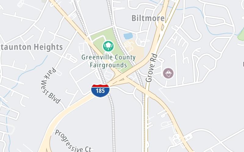
This location's approximate GPS Coordinates are 34.80171 x -82.42789.

Interactive Map Below


Which directions can I travel from here?

From this junction, traffic can only enter going southbound. Traffic can only exit going northbound.

On to Grove Road, about 0.5 miles away ►

◄ Back to I-85, about 1.3 miles away.

Nearby gas and food are shown on the interactive map below.

View Map

Weather & Visibility

  • 22 7 03
  • Mostly Cloudy

    61°F / 15.9°C

    Feels Like

    63°F / 17.2°C

  • Visibility

    9 Mi / 14.5 Km

    3 Hr Precip

    0 In / 0.0 Cm

  • SSW Wind

    2.2 Mi / 3.6 Km

    Gusts

    6 Mi / 9.6 Km


Available Cameras

No camera feed …

There is no currently-available traffic camera feed for this location.

Advertising

Closest Food, Gas, EV And Other Services Near White Horse Road

The map shows traffic cameras and services in about a two-mile radius. Not all locations have cameras

Advertising

Discover South Carolina Attractions

Hotels and destinations header

Hotels & Airports

Destination Travel

Advertising
Advertising

EXPLORE SOUTH CAROLINA

Journey to key destinations around and adjacent to South Carolina!

Map Of This Region ▹

Communities in this metro area include Greenville, Spartanburg, Piedmont, Simpsonville, Anderson, and Asheville, North Carolina.

Individual toll maps for this region are listed below.

Map Of This Region ▹

Communities in this metro area include Columbia, West Columbia, Forest Acres, Orangeburg, Sumter, and Newberry.

Individual toll maps for this region are listed below.

greater columbia-state capitol

Roads Within Region

Map Of This Region ▹

Map Of This Region ▹

Communities in this metro area include Myrtle Beach, Carolina Forest, Arcadian Shores, North Myrtle Beach, Surfside Beach, and Murrells Inlet.

Individual toll maps for this region are listed below.

myrtle beach

Roads Within Region

Map Of This Region ▹

Map Of This Region ▹

Communities in this metro area include Charleston, Isle Of Palms, Kiawah Island, Johns Island, Folly Beach, North Charleston, and Goose Creek.

Individual toll maps for this region are listed below.

charleston

Roads Within Region

Map Of This Region ▹

Map Of This Region ▹

Communities in this metro area include Charlotte, Wesley Chapel, Monroe, Unionville, and Fairview.

Individual toll maps for this region are listed below.

Static map of Southern Connector at White Horse Road

Static map. Interactive map is above.

Advertising
Advertising
Turnpikes.com is proud to partner with the following: