Hood River Bridge At Lewis And Clark Hwy / WA SR 14

Advertising
Advertising

Map & services within two (2) miles

Interactive map shows available cameras, plus nearby fuel, food and lodging

See below for more about this area

Advertising
Advertising

About This Location

Lewis and Clark Hwy / WA SR 14
Map image © TomTom Intl BV

At A Glance

This junction is located in White Salmon WA.

Interactive Map Above

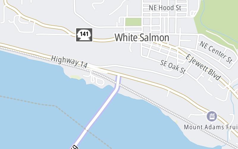
This location's approximate GPS Coordinates are 45.72401 x -121.48998.

Which directions can I travel from here?

From this junction, traffic can only enter going southbound. Traffic can only exit going northbound.

This location also connects with Washington.

Which direction are tolls charged here?

Tolls are not charged or collected at this junction.

View Map Travel Conditions


Using The POI Map

The interactive map and lists on this page include key traveler services within two miles of this destination point.

You will find common services, including gas stations, truck stops, EV charging facilities, fast-food or family restaurants, and hotels. These are displayed on the interactive map as markers, which you can select for more information.

Current driving conditions and weather, along with a more complete list of key services, may be found below the map.

View Map Weather

Static map of Hood River Bridge at Lewis and Clark Hwy / WA SR 14
Static map. Interactive map is above.
Advertising
Advertising

Travel Conditions At Lewis and Clark Hwy / WA SR 14

Current Weather And Visibility

  • 06 6 08
  • Mostly Cloudy

    68°F / 19.9°C

    Feels Like:

    66°F / 18.8°C

  • Visibility

    10 Mi / 16.1 Km

    3-Hour Precip:

    0 In / 0.0 Cm

  • West
    Winds (W)

    3.9 MPH / 6.3 KPH

    Gusts:

    13 MPH / 20.9 KPH

▸ Get the full forecast for This Location

Available Cameras

No camera feed …

There is no currently-available traffic camera feed for this location.

Advertising
Advertising

Travel Pictures

No photos …

There are no currently-available photos for this location.

Advertising
Advertising

Closest Food, Gas, EV And Other Services Near Lewis and Clark Hwy / WA SR 14

The map above shows all services within about a two (2) mile radius.

Hotels and destinations header

Hotels & Airports

Destination Travel

Fuel, EV and convenience store header

Gas & EV Charging

Closest Gas Stations

Shell

SHELL

1108 East Marina Way • 0.99 miles

Store/Fuel Brand: Shell

Chevron

CHEVRON

949 East Marina Way • 1.02 miles

Store/Fuel Brand: Chevron

SINCLAIR

204 West Steuben Street • 1.22 miles

Store/Fuel Brand: Sinclair

Chevron

CHEVRON

102 East Steuben Street • 1.32 miles

Store/Fuel Brand: Chevron

View Map

Closest EV Chargers

ChargePoint

CHARGEPOINT

1108 East Marina Way • 0.98 miles

WHITE SALMON FIRE HALL

119 Northeast Church Street • 1,953 feet

CITY OF BINGEN PARKING

404 West Steuben Street • 1.08 miles

CITY OF BINGEN CAR SHARE

400 West Steuben Street • 1.11 miles

View Map

Coffee, snacks and dining header

Fast Food & Beverage

Closest Fast Food

Fast food refers ONLY to quick-service and take-out diners. All restaurant types are shown on the map above.

WHITE SALMON BAKING CO.

80 Northeast Estes Avenue • 0.38 miles

McDonald's

MCDONALD'S

910 West Steuben Street • 0.81 miles

McDonald's

MCDONALD'S

1049 East Marina Way • 1.01 miles

TAQUERIA EL RINCONCITO EXPRESS

114 West Steuben Street • 1.26 miles

MUGS COFFEE

120 West Steuben Street • 1.29 miles

IXTAPA TAQUERíA EXPRESS

403 Portway Avenue • 1.35 miles

GROUND

12 Oak Street • 1.45 miles

STOKED ROASTERS & COFFEE

603 Portway Avenue • 1.46 miles

View Map

Discover Oregon Attractions

Advertising
Advertising

EXPLORE OREGON

Journey to key destinations around and adjacent to Oregon!

Advertising
Advertising
Turnpikes.com is proud to partner with the following: