This Location At A Glance
This is Exit 14 of the Spaulding Turnpike.
This junction is located in Rochester. NOTE: SB On/NB Off.
This location is in the Portsmouth - Dover area.
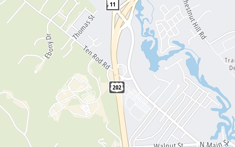
This location's approximate GPS Coordinates are 43.31284 x -70.99614.
Which directions can I travel from here?
From this junction, traffic can only enter going southbound. Traffic can only exit going northbound.
On to NH 11/N Main St/Farmington Rd, about 0.5 miles away ►
◄ Back to US 202 / Washington Street, about 1.1 miles away.
This location also connects with Maine.
Nearby gas and food are shown on the interactive map below.
Weather & Visibility

Cloudy
48°F / 9°C
Feels Like
50°F / 9.8°C

Visibility
5 Mi / 8 Km
3 Hr Precip
0.05 In / 0.1 Cm

-
NNE Wind
1.1 Mi / 1.8 Km
Gusts
3.5 Mi / 5.6 Km
See the full forecast for This Location or the Portsmouth - Dover area
Conditions and forecasts provided in partnership with AccuWeather.

Weather provided in partnership with AccuWeather.
Available Cameras
No camera feed …
There is no currently-available traffic camera feed for this location.


 Everett Turnpike ▹
 Blue Star Turnpike ▹
 Spaulding Turnpike ▹
 Maine Turnpike ▹


