This Location At A Glance
This junction is located in . NOTE: Rainy River.
This location is in the Northeast Minnesota area.
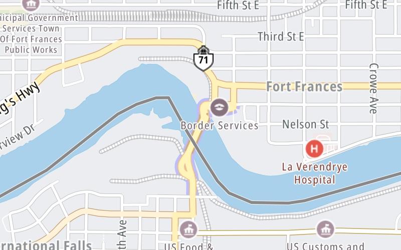
This location's approximate GPS Coordinates are 48.60780 x -93.40146.
Which directions can I travel from here?
From this junction, traffic can enter traveling both southbound and northbound. Traffic can also exit traveling both southbound and northbound.
On to Canada Border Services, about 0.1 miles away ►
◄ Back to US Customs, about 0.2 miles away.
Nearby gas and food are shown on the interactive map below.
Weather & Visibility

Clear
35°F / 1.6°C
Feels Like
37°F / 2.8°C

Visibility
12 Mi / 19.3 Km
3 Hr Precip
0 In / 0.0 Cm

-
NW Wind
2.2 Mi / 3.5 Km
Gusts
2.2 Mi / 3.5 Km
See the full forecast for the Northeast Minnesota area
Conditions and forecasts provided in partnership with AccuWeather.

Weather provided in partnership with AccuWeather.
Available Cameras
No camera feed …
There is no currently-available traffic camera feed for this location.

 International Bridge ▹

 Mackinac Bridge ▹


