This Location At A Glance
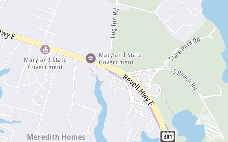
This is Exit 32 of the Wm Preston Lane Jr Memorial Bridge.
This junction is located in Annapolis. Arnold and Cape St Claire are nearby.
This location is in the Washington Metro area; it also overlaps with the Baltimore area.
This location's approximate GPS Coordinates are 39.01978 x -76.41454.
Which directions can I travel from here?
From this junction, traffic can only enter going eastbound. Traffic can only exit going westbound.
On to Romancoke Road, about 5.8 miles away ►
Nearby gas and food are shown on the interactive map below.
Weather & Visibility

Clear
59°F / 15.1°C
Feels Like
60°F / 15.7°C

Visibility
10 Mi / 16.1 Km
3 Hr Precip
0 In / 0.0 Cm

-
SW Wind
1.8 Mi / 3 Km
Gusts
3.8 Mi / 6.1 Km
See the full forecast for This Location or the Washington Metro area
Conditions and forecasts provided in partnership with AccuWeather.

Weather provided in partnership with AccuWeather.
Available Cameras

1.07 Mi
2.21 Mi
2.83 Mi

 Wm Preston Lane Jr Memorial Bridge ▹
 Fort McHenry Tunnel ▹
 Francis Scott Key Bridge ▹
 Baltimore Harbor Tunnel ▹
 Intercounty Connector MD 200 ▹
 Thomas J Hatem Memorial Bridge ▹
 Dulles Greenway ▹
 Delaware Memorial Bridge ▹
 Delaware Turnpike ▹
 State Route 1 ▹


