Interactive map shows available cameras, plus nearby fuel, food and lodging
See below for more about this area
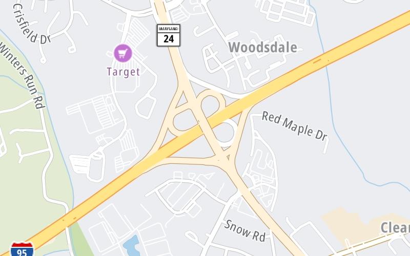
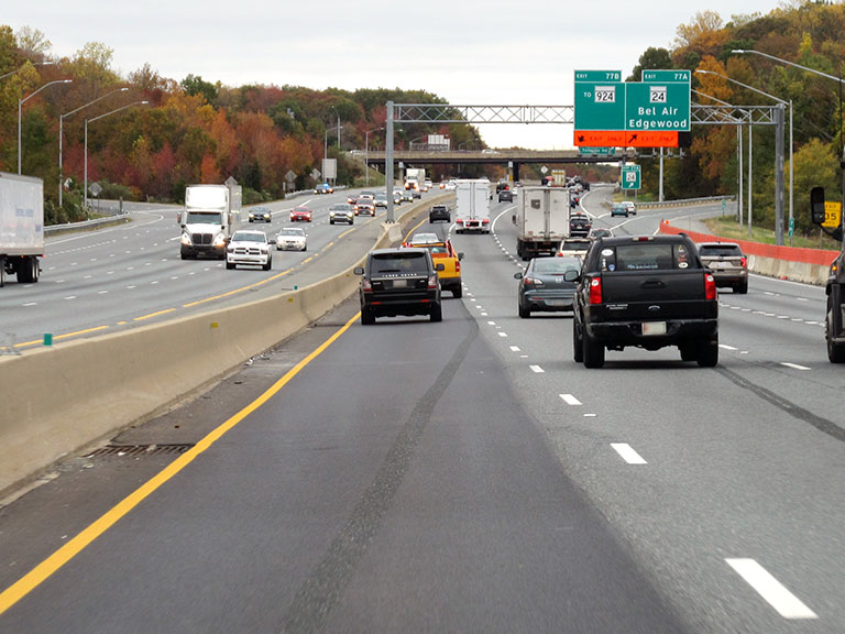
This is Exit 77A/77B of the John F Kennedy Memorial Highway.
This junction is located in Bel Air. Edgewood is nearby. NOTE: to MD 924.
This location is in the Baltimore area.
This location's approximate GPS Coordinates are 39.45679 x -76.31004.
Which directions can I travel from here?
From this junction, traffic can enter traveling both southbound and northbound. Traffic can also exit traveling both southbound and northbound.
On to MD 543 / Riverside Parkway, about 3.6 miles away ►
◄ Back to MD 152 / Mountain Road, about 2.5 miles away.
Which direction are tolls charged here?
Tolls are not charged or collected at this junction.
The interactive map and lists on this page include key traveler services within two miles of this destination point.
You will find common services, including gas stations, truck stops, EV charging facilities, fast-food or family restaurants, and hotels. These are displayed on the interactive map as markers, which you can select for more information.
Current driving conditions and weather, along with a more complete list of key services, may be found below the map.
Static map. Interactive map is above.Mostly Cloudy
78°F / 25.4°C
Feels Like:
77°F / 25°C
Visibility
10 Mi / 16.1 Km
3-Hour Precip:
0 In / 0.0 Cm
East Northeast
Winds (ENE)
3.3 MPH / 5.3 KPH
Gusts:
7.8 MPH / 12.6 KPH
▸ Get the full forecast for This Location | The Baltimore area
About this photo:
Two exit lanes open up on the right-hand side of the expressway as northbound traffic approaches Exits 77A and 77B on the JFK Memorial Highway. Northbound, 77A, for MD 24, is the first ramp, and MD 924 is the second ramp.
Photo taken 10-29-2019
The map above shows all services within about a two (2) mile radius.
Destination Travel
Closest Gas Stations
WAWA
3500 Woodsdale Road • 0.60 miles
Store/Fuel Brand: Wawa
EXXON
3424 Emmorton Road • 0.70 miles
Store/Fuel Brand: Exxon
ROYAL FARMS
10 Box Hill South Parkway • 0.92 miles
Store/Fuel Brand: Royal Farms
EXXON
1804 Edgewood Road • 1,643 feet
Store/Fuel Brand: Exxon
Closest EV Chargers
Closest Fast Food
Fast food refers ONLY to quick-service and take-out diners. All restaurant types are shown on the map above.
HUNT BROTHERS PIZZA
1811 Edgewood Road • 0.39 miles
PANDA EXPRESS
403 Constant Friendship Boulevard • 0.50 miles
CHICK-FIL-A
408 Constant Friendship Boulevard • 0.52 miles
TACO BELL
406 Constant Friendship Boulevard • 0.54 miles
KFC
406 Constant Friendship Boulevard • 0.54 miles
MCDONALD'S
404 Constant Friendship Boulevard • 0.55 miles
JIMMY JOHN'S
3454 Emmorton Road • 0.74 miles
PANERA BREAD
3412 Merchant Boulevard • 0.84 miles
Journey to key destinations around and adjacent to Maryland!
Communities in this metro area include Baltimore, Edgewood, Columbia, Laurel, and Gaithersburg.
Individual toll maps for this region are listed below.
Communities in this metro area include Washington, Dc, Fairfax County, Virginia, Loundoun County, Virginia, Montgomery County, Maryland, and Prince George's County, Maryland.
Individual toll maps for this region are listed below.
Communities in this metro area include Wilmington, Middletown, Newark, and Carneys Point, New Jersey.
Individual toll maps for this region are listed below.