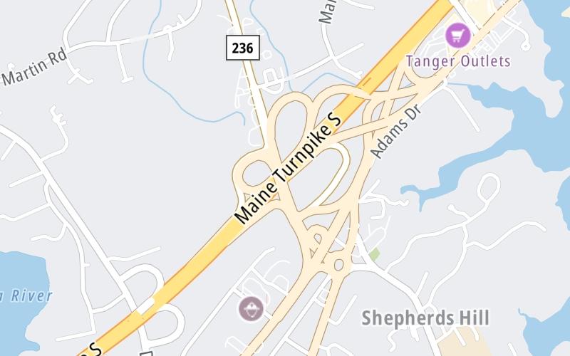
This is Exit 3 of the Maine Turnpike.
This junction is located in Kittery. South Berwick is nearby. NOTE: No SB Off.
This location's approximate GPS Coordinates are 43.10454 x -70.74740.
Which directions can I travel from here?
From this junction, traffic can enter traveling both southbound and northbound. Traffic can only exit going northbound.
On to Maine State Visitor Information Center, about 2.2 miles away ►
◄ Back to North US 1 / ME 236, about 0.3 miles away.
This location also connects with New Hampshire.
Which direction are tolls charged here?
Tolls are not charged or collected at this junction.
Use the map below for all services within about a two (2) mile radius.
Closest Gas Stations

MOBIL
286 US Route 1 • 0.67 miles
Store/Fuel Brand: Mobil

7-ELEVEN
169 State Road • 1,870 feet
Store/Fuel Brand: 7-Eleven
IRVING
103 US Route 1 Bypass • 1,933 feet
Store/Fuel Brand: Irving
IRVING
2 Shapleigh Road • 1.24 miles
Store/Fuel Brand: Irving
Closest EV Chargers
Closest Fast Food
Fast food refers ONLY to quick-service and take-out diners. All restaurant types are shown on the map below.
TAYLOR LOBSTER
32 Route 236 • 0.44 miles
BOB'S CLAM HUT
315 US Route 1 • 0.87 miles
SUE'S SEAFOOD
33 Old Post Road • 0.88 miles
NEW ENGLAND FISHMONGERS
57 State Road • 0.96 miles
TACOCAT
230 State Rd • 1,299 feet
LA CASITA
181 Rogers Rd • 1,408 feet
AMATO'S KITTERY
103 US Route 1 Bypass • 1,842 feet

DAIRY QUEEN
174 State Road • 1,922 feet
The interactive map and lists on this page include key traveler services in a two-mile radius, including gas stations, truck stops, EV charging facilities, fast-food or family restaurants, and hotels.
Current driving conditions and weather, may be found below.

Clear
21°F / -6°C
Feels Like:
20°F / -6.7°C
Visibility
21 Mi / 33.8 Km
3-Hour Precip:
0 In / 0.0 Cm
West Northwest
Winds (WNW)
4.9 MPH / 7.8 KPH
Gusts:
15.7 MPH / 25.2 KPH
▸ Get the full forecast for This Location
Destination Travel
Journey to key destinations around and adjacent to Maine!
Communities in this metro area include Portland, Scarborough, and Biddeford.
Individual toll maps for this region are listed below.
Communities in this metro area include Augusta, Gardiner, Farmingdale, and Manchester.
Individual toll maps for this region are listed below.
Communities in this metro area include Portsmouth, Dover, Durham, Rochester, Kittery, Maine, and York, Maine.
Individual toll maps for this region are listed below.