Kansas Turnpike At US 69 South/S 18th St Expy / N 18th St

Advertising
Advertising

Map & services within two (2) miles

Interactive map shows available cameras, plus nearby fuel, food and lodging

See below for more about this area

Advertising
Advertising

About This Location

US 69 South/S 18th St Expy / N 18th St
Map image © TomTom Intl BV

At A Glance

This is Exit 420A / 4 of the Kansas Turnpike.

This junction is located in Kansas City.

This location is in the Kansas City - Topeka area.

Interactive Map Above

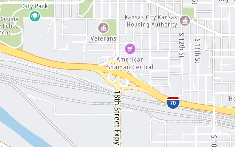
This location's approximate GPS Coordinates are 39.09605 x -94.64944.

Which directions can I travel from here?

From this junction, traffic can enter traveling both southbound and northbound. Traffic can also exit traveling both southbound and northbound.

On to I-670, about 1.0 mile away ►

◄ Back to I-70 WB to I-635 / Park Dr / N 38th St, about 0.8 miles away.

This location also connects with Missouri.

Which direction are tolls charged here?

Tolls are not charged or collected at this junction.

View Map Travel Conditions


Using The POI Map

The interactive map and lists on this page include key traveler services within two miles of this destination point.

You will find common services, including gas stations, truck stops, EV charging facilities, fast-food or family restaurants, and hotels. These are displayed on the interactive map as markers, which you can select for more information.

Current driving conditions and weather, along with a more complete list of key services, may be found below the map.

View Map Weather

Static map of Kansas Turnpike at US 69 South/S 18th St Expy / N 18th St
Static map. Interactive map is above.
Advertising
Advertising

Travel Conditions At US 69 South/S 18th St Expy / N 18th St

Current Weather And Visibility

  • 20 7 09
  • Mostly Cloudy

    73°F / 22.8°C

    Feels Like:

    75°F / 23.6°C

  • Visibility

    10 Mi / 16.1 Km

    3-Hour Precip:

    0 In / 0.0 Cm

  • North
    Winds (N)

    8.9 MPH / 14.3 KPH

    Gusts:

    7.5 MPH / 12 KPH

▸ Get the full forecast for This Location | The Kansas City - Topeka area

Available Cameras

I-70 WB AT LEWIS & CLARK VIADUCT

I-70 WB AT LEWIS & CLARK VIADUCT

Camera Direction: UNKNOWN. Source: MODOT - undetermined 66118

Cameras Closest To US 69 South/S 18th St Expy / N 18th St

Camera Direction: UNKNOWN. Source: MODOT - undetermined 66118

2.33 Mi

Advertising
Advertising

Travel Pictures

No photos …

There are no currently-available photos for this location.

Advertising
Advertising

Closest Food, Gas, EV And Other Services Near US 69 South/S 18th St Expy / N 18th St

The map above shows all services within about a two (2) mile radius.

Hotels and destinations header

Hotels & Airports

Destination Travel

Fuel, EV and convenience store header

Gas & EV Charging

Closest Gas Stations

Phillips 66

PHILLIPS 66

2100 Park Drive • 0.70 miles

Store/Fuel Brand: Phillips 66

VALERO

308 North 18th Street • 0.84 miles

Store/Fuel Brand: Valero

INNER CITY

540 South 10th Street • 0.90 miles

Store/Fuel Brand:

CENEX

164 South 18th Street • 1,341 feet

Store/Fuel Brand: Cenex

View Map

Closest EV Chargers

View Map

No EV charging stations nearby.

Coffee, snacks and dining header

Fast Food & Beverage

Closest Fast Food

Fast food refers ONLY to quick-service and take-out diners. All restaurant types are shown on the map above.

AY JALISCO

1264 Central Avenue • 0.64 miles

EL TORITO GRILL

1304 Central Avenue • 0.65 miles

CHURCH'S CHICKEN

1222 Central Avenue • 0.67 miles

ANTOJITOS CATRACHOS 504

1901 Park Drive • 0.67 miles

MAR DE ORO

331 South 10th Street • 0.78 miles

LITTLE CAESARS

151 South 18th Street • 1,143 feet

Wingstop

WINGSTOP

151 South 18th Street • 1,201 feet

KRISPY KRUNCHY CHICKEN

164 South 18th Street • 1,380 feet

View Map

Discover Kansas Attractions

Advertising
Advertising

EXPLORE KANSAS

Journey to key destinations around and adjacent to Kansas!

Map Of This Region ▹

Communities in this metro area include Kansas City, Kansas City, Missouri, Topeka, Lawrence, Overland Park, Edwardsville, and Bonner Springs.

Individual toll maps for this region are listed below.

Map Of This Region ▹

Communities in this metro area include Wichita, Bel Aire, Andover, Valley Center, and Maize.

Individual toll maps for this region are listed below.

Map Of This Region ▹

Communities in this metro area include Tulsa, Broken Arrow, Muskogee, Stillwater, Sapulpa, Vinita, Joplin, Missouri, Siloam Springs, Arkansas, and San Springs.

Individual toll maps for this region are listed below.

Map Of This Region ▹

Communities in this metro area include Stillwater and Tulsa.

Individual toll maps for this region are listed below.

Advertising
Advertising
Turnpikes.com is proud to partner with the following: