This Location At A Glance
This is Exit 177 of the Kansas Turnpike.
This junction is located in Topeka. NOTE: to US 75.
This location is in the Kansas City - Topeka area.
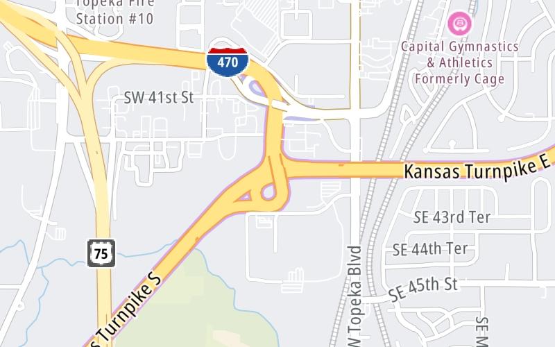
This location's approximate GPS Coordinates are 38.99143 x -95.69250.
Which directions can I travel from here?
From this junction, traffic can enter traveling both southbound and northbound. Traffic can also exit traveling both southbound and northbound.
On to Topeka K-4/I-470 Zone Gantry, about 2.2 miles away ►
◄ Back to Topeka I-470/Council Grove Zone Gantry, about 26.1 miles away.
Nearby gas and food are shown on the interactive map below.
Weather & Visibility

Mostly Cloudy
82°F / 27.8°C
Feels Like
83°F / 28.6°C

Visibility
10 Mi / 16.1 Km
3 Hr Precip
0 In / 0.0 Cm

-
SSW Wind
8.1 Mi / 13 Km
Gusts
8.1 Mi / 13 Km
See the full forecast for This Location or the Kansas City - Topeka area
Conditions and forecasts provided in partnership with AccuWeather.

Weather provided in partnership with AccuWeather.
Available Cameras
No camera feed …
There is no currently-available traffic camera feed for this location.


 Kansas Turnpike ▹

 Cherokee Turnpike ▹
 Creek Turnpike ▹
 Muskogee Turnpike ▹
 Turner Turnpike ▹
 Will Rogers Turnpike ▹
 Gilcrease Expressway West ▹


