This Location At A Glance
This is Exit 72 of the Connecticut Turnpike.
This junction is located in East Lyme.
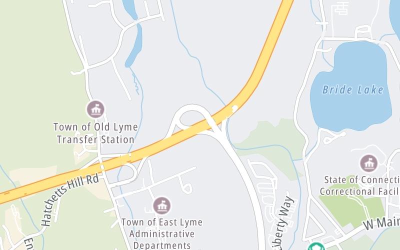
This location's approximate GPS Coordinates are 41.32527 x -72.25092.
Which directions can I travel from here?
From this junction, traffic can enter traveling both southbound and northbound. Traffic can also exit traveling both southbound and northbound.
On to Society Road, about 1.2 miles away ►
◄ Back to Four Mile River Road, about 0.6 miles away.
Nearby gas and food are shown on the interactive map below.
Weather & Visibility

Partly Cloudy
60°F / 15.5°C
Feels Like
61°F / 16.2°C

Visibility
11 Mi / 17.7 Km
3 Hr Precip
0 In / 0.0 Cm

-
W Wind
1.6 Mi / 2.6 Km
Gusts
4.4 Mi / 7 Km
See the full forecast for This Location
Conditions and forecasts provided in partnership with AccuWeather.

Weather provided in partnership with AccuWeather.
Available Cameras

3.32 Mi


 Connecticut Turnpike ▹
 Massachusetts Turnpike ▹


