This Location At A Glance
This is Exit 43 of the Connecticut Turnpike.
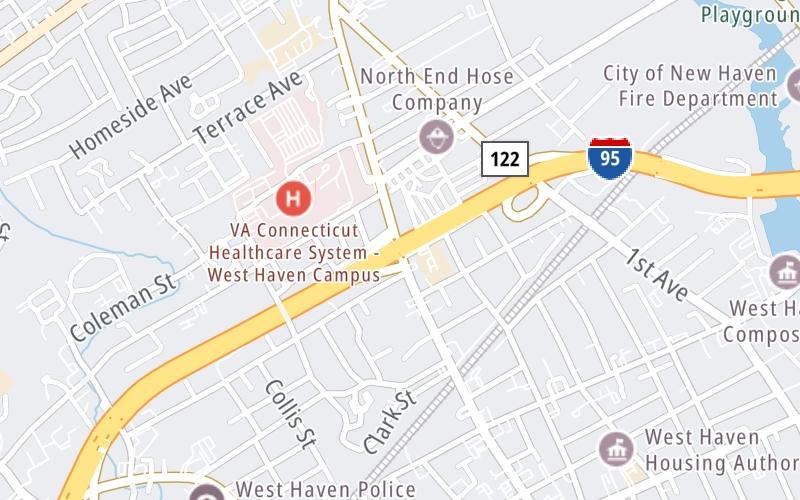
This junction is located in West Haven. NOTE: NB Off/SB On.
This location is in the New Haven - Bridgeport area.
This location's approximate GPS Coordinates are 41.28137 x -72.95612.
Which directions can I travel from here?
From this junction, traffic can only enter going southbound. Traffic can only exit going northbound.
On to CT 122/1st Avenue, about 0.0 miles away ►
◄ Back to CT 162/Saw Mill Road, about 0.9 miles away.
Nearby gas and food are shown on the interactive map below.
Weather & Visibility

Cloudy
55°F / 13°C
Feels Like
61°F / 16.3°C

Visibility
10 Mi / 16.1 Km
3 Hr Precip
0 In / 0.0 Cm

-
E Wind
3.9 Mi / 6.3 Km
Gusts
7.4 Mi / 11.9 Km
See the full forecast for This Location or the New Haven - Bridgeport area
Conditions and forecasts provided in partnership with AccuWeather.

Weather provided in partnership with AccuWeather.
Available Cameras

0.41 Mi
0.67 Mi
1.45 Mi
1.56 Mi
2.76 Mi


 Connecticut Turnpike ▹
 Massachusetts Turnpike ▹


