Share

Connecticut Turnpike At US 1 South

Advertising
Advertising

This Location At A Glance

This is Exit 39A of the Connecticut Turnpike.

This junction is located in Milford.

This location is in the New Haven - Bridgeport area.

US 1 South
Map image © TomTom Intl BV

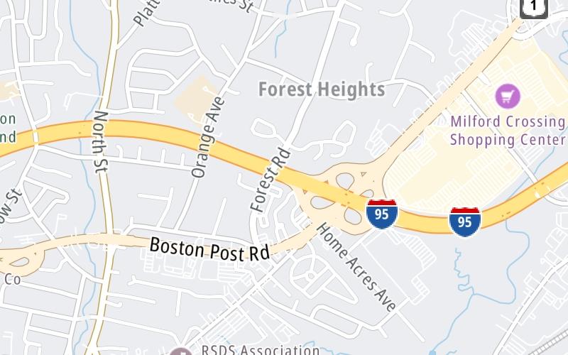
This location's approximate GPS Coordinates are 41.23520 x -73.04565.

Interactive Map Below


Which directions can I travel from here?

From this junction, traffic can enter traveling both southbound and northbound. Traffic can also exit traveling both southbound and northbound.

On to US 1 North, about 0.4 miles away ►

◄ Back to CT 15/Merritt Pkwy / Wilbur Cross Pkwy, about 1.3 miles away.

Nearby gas and food are shown on the interactive map below.

View Map

Weather & Visibility

  • 23 7 01
  • Mostly Cloudy

    17°F / -8.6°C

    Feels Like

    F / -15.1°C

  • Visibility

    10 Mi / 16.1 Km

    3 Hr Precip

    0 In / 0.0 Cm

  • WSW Wind

    9.1 Mi / 14.6 Km

    Gusts

    21.1 Mi / 33.9 Km


Available Cameras

I-95 @ ORANGE AVE

Camera direction: SOUTH. Bridgeport 06461.
Source: ConnDOT.

Camera direction: SOUTH. Bridgeport 06461.<br />Source: ConnDOT -

0.33 Mi

Camera direction: NORTH. Bridgeport 06460.<br />Source: ConnDOT -

0.33 Mi

Camera direction: NORTH. Bridgeport 06460.<br />Source: ConnDOT -

0.84 Mi

Camera direction: SOUTH. Bridgeport 06461.<br />Source: ConnDOT -

0.89 Mi

Camera direction: SOUTH. Bridgeport 06461.<br />Source: ConnDOT -

1.30 Mi

Advertising

Closest Food, Gas, EV And Other Services Near US 1 South

The map shows traffic cameras and services in about a two-mile radius. Not all locations have cameras

Advertising

Discover Connecticut Attractions

Hotels and destinations header

Hotels & Airports

Destination Travel

Advertising
Advertising

EXPLORE CONNECTICUT

Journey to key destinations around and adjacent to Connecticut!

Map Of This Region ▹

Communities in this metro area include New Haven, Bridgeport, Darien, Greenwich, Stamford, and Port Chester, New York.

Individual toll maps for this region are listed below.

Map Of This Region ▹

Communities in this metro area include Springfield, West Springfield, Chicopee, Westfield, and Hartford, Connecticut.

Individual toll maps for this region are listed below.

Static map of Connecticut Turnpike at US 1 South

Static map. Interactive map is above.

Advertising
Advertising
Turnpikes.com is proud to partner with the following: