Share

Connecticut Turnpike At Mill Plain Road

Advertising
Advertising

This Location At A Glance

This is Exit 21 of the Connecticut Turnpike.

This junction is located in Fairfield.

This location is in the New Haven - Bridgeport area.

Mill Plain Road
Map image © TomTom Intl BV

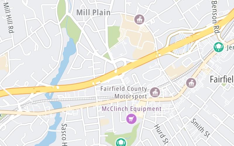
This location's approximate GPS Coordinates are 41.14397 x -73.26548.

Interactive Map Below


Which directions can I travel from here?

From this junction, traffic can enter traveling both southbound and northbound. Traffic can also exit traveling both southbound and northbound.

On to Round Hill Road, about 0.7 miles away ►

◄ Back to Bronson Road, about 0.6 miles away.

Nearby gas and food are shown on the interactive map below.

View Map

Weather & Visibility

  • 11 7 03
  • Mostly Sunny

    17°F / -8.5°C

    Feels Like

    19°F / -7°C

  • Visibility

    21 Mi / 33.8 Km

    3 Hr Precip

    0 In / 0.0 Cm

  • N Wind

    2.3 Mi / 3.7 Km

    Gusts

    7.5 Mi / 12.1 Km


Available Cameras

I-95 @ PINE CREEK RD, FAIRFIELD (EXIT 20-21)

Camera direction: NORTH. Bridgeport 06824.
Source: ConnDOT.

Camera direction: NORTH. Bridgeport 06824.<br />Source: ConnDOT -

0.27 Mi

Camera direction: NORTH. Bridgeport 06824.<br />Source: ConnDOT -

0.50 Mi

Camera direction: SOUTH. Bridgeport 06890.<br />Source: ConnDOT -

1.03 Mi

Camera direction: SOUTH. Bridgeport 06825.<br />Source: ConnDOT -

2.63 Mi

Camera direction: NORTH. Bridgeport 06880.<br />Source: ConnDOT -

2.65 Mi

Advertising

Closest Food, Gas, EV And Other Services Near Mill Plain Road

The map shows traffic cameras and services in about a two-mile radius. Not all locations have cameras

Advertising

Discover Connecticut Attractions

Hotels and destinations header

Hotels & Airports

Destination Travel

Advertising
Advertising

EXPLORE CONNECTICUT

Journey to key destinations around and adjacent to Connecticut!

Map Of This Region ▹

Communities in this metro area include New Haven, Bridgeport, Darien, Greenwich, Stamford, and Port Chester, New York.

Individual toll maps for this region are listed below.

Map Of This Region ▹

Communities in this metro area include Springfield, West Springfield, Chicopee, Westfield, and Hartford, Connecticut.

Individual toll maps for this region are listed below.

Static map of Connecticut Turnpike at Mill Plain Road

Static map. Interactive map is above.

Advertising
Advertising
Turnpikes.com is proud to partner with the following: