This Location At A Glance
This toll point is located in Brighton. Denver is nearby.
This location is in the Denver - Aurora area.
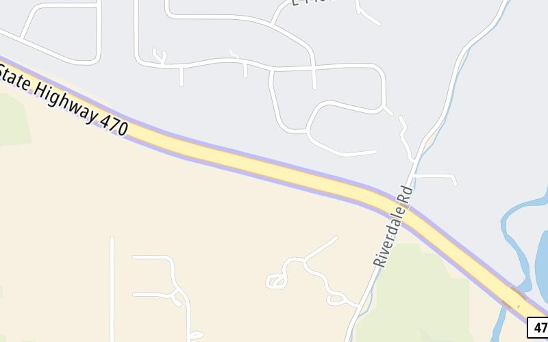
Map image © TomTom Intl BV
This location's approximate GPS Coordinates are 39.95357 x -104.87418.
On to Quebec Street, about 1.7 miles away ►
◄ Back to US Hwy 85, about 2.3 miles away.
Nearby gas and food are shown on the interactive map below.
Weather & Visibility

A Shower
48°F / 9°C
Feels Like
46°F / 7.6°C

Visibility
1 Mi / 2 Km
3 Hr Precip
0.02 In / 0.1 Cm

-
ENE Wind
5.1 Mi / 8.2 Km
Gusts
10.6 Mi / 17 Km
See the full forecast for the Denver - Aurora area
Conditions and forecasts provided in partnership with AccuWeather.

Weather provided in partnership with AccuWeather.
Available Cameras
No camera feed …
There is no currently-available traffic camera feed for this location.
Advertising

 E-470 ▹
 Northwest Parkway ▹


