Interstate 75 At US 35 / SR 4

Advertising
Advertising

Your selected location relative to roadway

See below for more about this area

Advertising
Advertising

About This Location

US 35 / SR 4

At A Glance

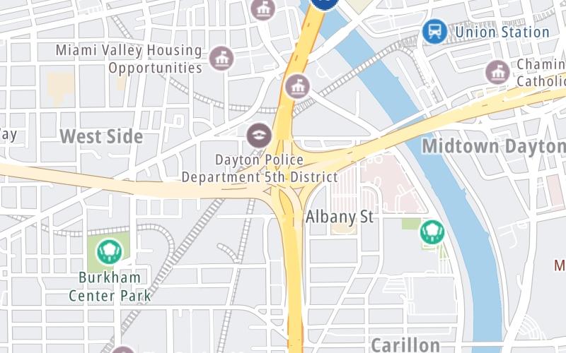
This is Exit 53 of I-75.

This freeway is located in Dayton.

This location's approximate GPS Coordinates are 39.74785 x -84.20553.

View Map Travel Conditions

Above: Map image © TomTom Intl BV

Using The POI Map

The interactive map will help you orient this location in relationship to other junctions.

Current weather and driving conditions may be found below, and any available photos of this location.

View Map Weather

Because of the nature of this location, no services are displayed. On most exit or junction pages, a summary of the closest services around the junction will be shown, along with detailed lists of services within two miles.

Advertising
Advertising

Travel Conditions At US 35 / SR 4

Current Weather And Visibility

  • 06 6 07
  • Mostly Cloudy

    74°F / 23.4°C

    Feels Like:

    79°F / 26.3°C

  • Visibility

    10 Mi / 16.1 Km

    3-Hour Precip:

    0 In / 0.0 Cm

  • West Southwest
    Winds (WSW)

    2.8 MPH / 4.5 KPH

    Gusts:

    8.1 MPH / 13 KPH

Available Cameras

I-75 @ US-35

I-75 @ US-35

Camera Direction: SOUTH. Source: ODOT - Dayton 45417

Cameras Closest To US 35 / SR 4

Camera Direction: SOUTH. Source: ODOT - Dayton 45417

274 Ft

Camera Direction: WEST. Source: ODOT - Dayton 45402

0.60 Mi

Camera Direction: NORTH. Source: ODOT - Dayton 45422

0.85 Mi

Camera Direction: SOUTH. Source: ODOT - Dayton 45405

1.28 Mi

Camera Direction: NORTH. Source: ODOT - Dayton 45439

1.41 Mi

Advertising
Advertising

Travel Pictures

No photos …

There are no currently-available photos for this location.

Advertising
Advertising

EXPLORE OHIO

Journey to key destinations around and adjacent to Ohio!

Map Of This Region ▹

Communities in this metro area include Cleveland, Akron, Boardman, Lorain, Aurora, Youngstown, New Castle, Pennsylvania, and Beaver Falls, Pennsylvania.

Individual toll maps for this region are listed below.

Map Of This Region ▹

Communities in this metro area include Toledo, Perrysburg, Maumee, Montpelier, and Wauseon.

Individual toll maps for this region are listed below.

Map Of This Region ▹

Communities in this metro area include Castalia, Sandusky, Norwalk, Bellevue, Huron, Milan, and Monroeville.

Individual toll maps for this region are listed below.

Map Of This Region ▹

Communities in this metro area include Columbus, Upper Arlington, Westerville, New Albany, Worthington, Dublin, Pickerington, and Reynoldsburg.

Individual toll maps for this region are listed below.

columbus-state capital

Roads Within Region

Map Of This Region ▹

Map Of This Region ▹

Communities in this metro area include Cincinnati, Norwood, Cheviot, Northbrook, Reading, Covington, Kentucky, and Newport, Kentucky.

Individual toll maps for this region are listed below.

cincinnati-covington

Roads Within Region

Map Of This Region ▹

Map Of This Region ▹

Communities in this metro area include Gary, South Bend, Elkhart, Portage, and Fremont.

Individual toll maps for this region are listed below.

Map Of This Region ▹

Communities in this metro area include Pittsburgh, Cranberry Township, Beaver Valley, New Castle, Washington, Uniontown, Cheat Lake, West Virginia, Boardman, Ohio, and Youngstown, Ohio.

Individual toll maps for this region are listed below.

Map Of This Region ▹

Communities in this metro area include Parkersburg, North Hills, Vienna, and Belpre, Ohio.

Individual toll maps for this region are listed below.

Map Of This Region ▹

Communities in this metro area include Detroit, Grosse Ile, Ann Arbor, Pontiac, and Lansing.

Individual toll maps for this region are listed below.

Advertising
Advertising
Turnpikes.com is proud to partner with the following: